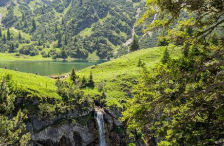
Gjallica mountain (Gjallica e Lumës) is an outstanding mountain located in the North-east of Albania, in the region of Kukës, and it is the highest mountain there. The highest peak of this mountain is called the Gjallica peak, and its elevation is 2’489 m/alt, and from the top, you have a stunning view of the city of Kukës, Albanian Alps, Koritnik mountain, Pashtrik mountain and many more.
Because it is the highest in that region, and its shape, it is called as the Balcony of the Nothern Albania.
There are many routes on how to climb it, but I will explain the trail from the small village of Brekije to the Gjallica summit.
How to get to Brekije
The village of Brekije, located around 25 km from the city of Kukës, and around 60 km from the city of Prizren, Kosovo. Getting there is easy if you have a car, but, by public transport, I am not sure if there is any possibility.
Follow the road from Kukës to Shishtavec, and then turn right to the village of Topojan. From there, you will face an unpaved road, and with small cars, I wouldn’t prefer going further than Topojan.
The distance of the unpaved road is around 3.5 km, so I would suggest walking it. Brekije is the starting point for this hike.
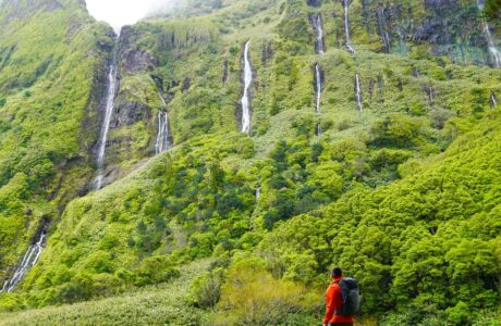
About the Brekije to Gjallica mountain peak hike
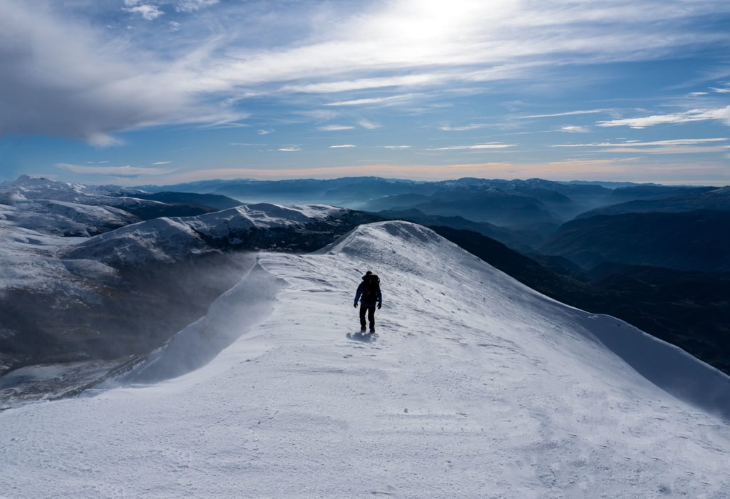
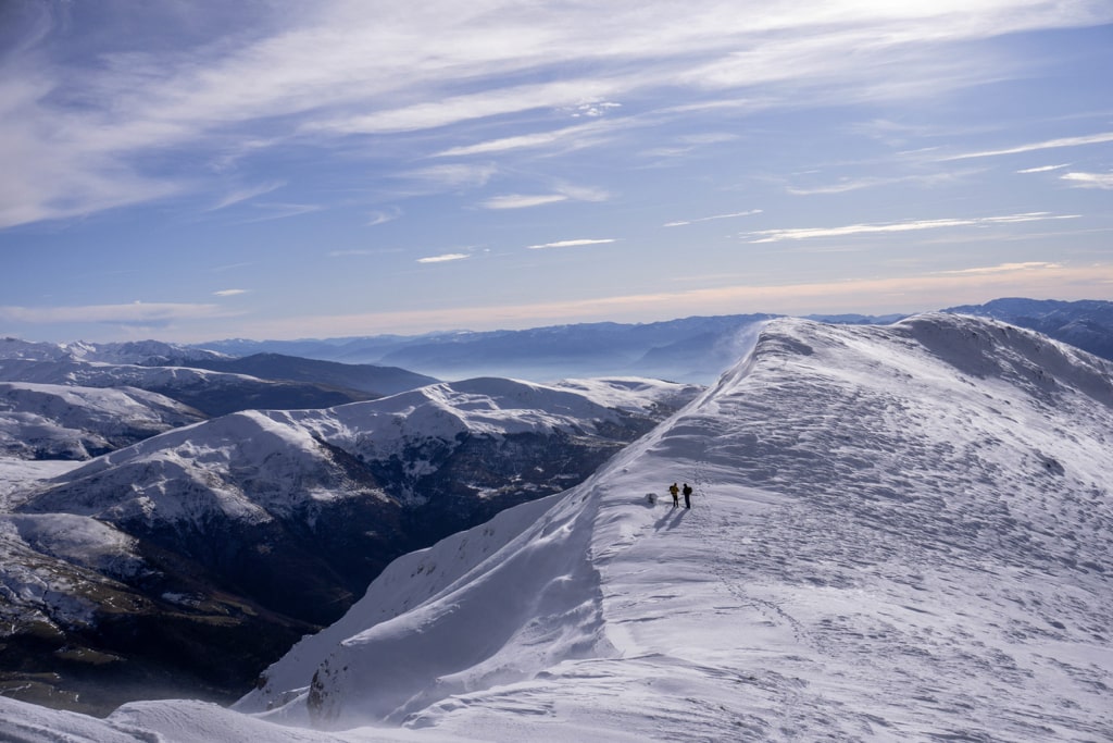
In the village of Brekije, you start ascending and passing the village through some beautiful fields. After the fields, you will go into a forest, where the trail is quite visible. When passing the trail, some mountain huts will be there, which are used by local shepherds during the summertime. From there, you can see the beautiful ridge of the Gjallica mountain standing in front of you. Start ascending to the ridge, and then just follow the ridge to arrive at the top of Gjallica. The time when you can hike this mountain is late Spring until Autumn, but for the bravest, you can go during wintertime as well, just make sure you have some extra layers and proper winter types of equipment.
The view from the top is breathtaking. Check it out:
Points of interest:
Starting point: Brekije, Kukës
Starting altitude: 1’200 m/alt
Highest altitude: 2’489 m/alt
Elevation gain: 1’300 m/alt
Total distance: 13 km (from Topojan 20 km)
I’ve attached the wikiloc trail to the Gjallica summit and back. You can download and follow it:
Last modified: October 9, 2025


[…] you can find the starting point for a more challenging but equally beautiful hike, as the one to Mount Gjallica (2489 m/alt), which is called the Balcony of Northern […]
[…] Read more: Gjallica Mountain […]
[…] you can find the starting point for a more challenging but equally beautiful hike, as the one to Mount Gjallica (2489 m/alt), which is called the Balcony of Northern […]
[…] triangle view that I was grown with. The triangle I am mentioning is Pashtrik, Koritnik, and Gjallica. Koritnik mountain is located on the border between Kosovo and Albania, and it is surrounded by the […]