Lake Bovilla, wonderful outdoor day trip

· updated · 2 min read
A hiker in a red shirt overlooks turquoise Lake Bovilla and green mountains under a cloudy blue sky
Lake Bovilla, Albania
Distance
3.4 km
Time
about 2 hours
Ascent
+221 m
Descent
−210 m
High point
517 m
Difficulty
Moderate

The route

Lake Bovilla, on the map

From my own GPX track. Move along the elevation profile or along the line on the map: both show the same point.

Distance3.4km
Timeabout 2 hours
Ascent+221m
Descent−210m
High point517m
DifficultyModerate

Walking time at your paceAn estimate without breaks, worked out from the distance and the climb.

  • Relaxed2 h
  • Average1 h 35 min
  • Fast1 h 15 min

Elevation

Elevation profile of Lake Bovilla, wonderful outdoor day tripStarts at 300 m, climbs 221 m in total to a high point of 517 m after 1.5 km, and finishes at 312 m; 3.4 km in all.300 m400 m500 m0.0 km0.5 km1.0 km1.5 km2.0 km2.5 km3.0 kmBovilla LakeGamti Mountain · 517 m

How steep

  • 0.7 kmUnder 8%
  • 1.7 km8 to 15%
  • 0.8 km15 to 25%
  • 0.2 kmOver 25%

In two parts

Embed this map

Paste this into your page or post (in WordPress: a Custom HTML block). The map stays up to date with the guide, and the link under it leads your readers to the full guide.

What to pack13 things, for a summit, a swim

Every hike

For the summit

Water and sun

The light for photographs

Today at Gamti Mountain: sunrise 06:14, sunset 16:33.

Today at Gamti Mountain: sunrise 06:14, sunset 16:33.

At Gamti Mountain, 517 m, in local time (Europe/Tirane), with an open horizon: the mountains around can hide the sun sooner.

In short

This moderate hike climbs Gamti Mountain above Lake Bovilla, near Tirana. The route is 3.4 km and takes about 2 hours, with 221 m of ascent. There is no water source on the mountain, so bring at least 1.5 litres.

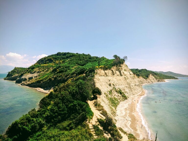
Lake Bovilla, also known as Bovilla Reservoir, is a hidden gem in Albania. It provides most of the drinking water for the capital, Tirana. Located just 15 km from the city, it is easily accessible. You can visit the lake for a picnic or enjoy a hike to the Gamti mountain, where the view of Bovilla Lake is breathtaking. Here is some useful information to plan your visit.

Turquoise Lake Bovilla winding between green mountain slopes beneath a cloudy sky

How to get to Lake Bovilla

The best way to reach the lake is through the municipality of Kamëz (Bathore), then by passing through a village called Zall-Herr (a military base is located there). There is a traffic sign where you need to turn right. From that sign, the road is unpaved. You just need to follow this road through Herraj village, and you will arrive at Lake Bovilla. If you want to use Google Maps, search for Bovilla Climbing Area instead of Bovilla Lake or Bovilla Reservoir.

A hiker in a red shirt overlooks turquoise Lake Bovilla and green mountains under a cloudy blue sky

Where to eat

There are no supermarkets near Bovilla. The last minimarket is in Herraj village, but it’s recommended to buy your supplies in the supermarkets in Bathore, Kamëz. Lately, I think that there is a new restaurant opened near Bovilla, but haven’t tried it yet. During the summer, there is a small bar next to the lake where you can enjoy a drink, some grilled food, and maybe go for a swim, as well.

About the hike to Gamti mountain

The hike to Gamti mountain is moderate, and now you have a lot of safe stairs. There is no water source on the mountain, so make sure you have at least 1.5 liters of water with you. The hike takes about 2 hours. When you reach the peak, the view of the watercolor of Bovilla is breathtaking. You can follow the route on the map and download the GPX above.
Share this guide

Questions and comments

43 comments

  1. Tobias

    Hey, great pictures! One question: you say it takes two hours. Is that to the peak or round trip back to the start?

    Reply

    1. Granit Author

      Hey, thanks!
      It takes around 2 hours roundtrip. It is not very far.

      Reply

  2. Tobias

    That is good news, we are arriving tomorrow afternoon in Tirana and I was wondering to do a sunset hike, which should be possible with that timing 🙂

    BTW: great article also concerning the beaches in the south. I hope we manage to find them 😉

    Reply

  3. Matt Whiting

    Thanks for the information, looks good.

    Just wondering if you know anything about the road coming in from the north? It looks like a dirt track and was wondering if it is passable in a car or if I’d need a 4×4?

    Thanks

    Matt

    Reply

    1. Granit Author

      Hey Matt,

      It is impossible going there in a normal car. You may need a 4×4 car!

      Reply

  4. James

    Hi,

    Hoping to do this in the summer, looks amazing! Is the track well signposted please? Also, you mention a small bar next to the lake – is this at the start of the track?

    Thanks

    Reply

    1. Granit Author

      Yes, it is quite close to the start of the trail, down near the river.

      Reply

  5. Eric

    Is it possible to make the drive on the road from the south from Tirana in a non 4×4 vehicle? Thanks!

    Reply

    1. Granit Author

      Yes, it is possible!

      Reply

  6. Flora

    Hello! Thank you for the post, it’s really hepful. Is it possible to go there without a 4×4 vehicle? We have a Transporter 4. 🙂

    Reply

    1. Granit Author

      Yes, it is possible!

      Reply

  7. Ryan

    I was wondering if the hike was well-marked or do you recommend downloading a map? We plan on doing it ourselves and was not sure. Thank you.

    Reply

    1. Granit Author

      Hi Ryan, I think that now it is quite well marked. Just go for it 😀

      Reply

  8. Albert

    Hey is it possible to take public transport from Tirana to the hike starting point?

    Reply

    1. Granit Author

      Hi Albert, no there is no public transport that sends you to the starting point. However, you can take a taxi and go there, it is quite close to Tirana.

      Reply

  9. Sinine

    Hi,
    thanks for this post and these pictures. As there is no public transport and you will need a taxi instead – how to return to Tirana? I guess there aren’t any taxis on site. So you will have to call a taxi company in the city or arrange a taxi beforehand to pick you up at a certain time? Sorry, I am quite inexperienced when it comes to taxis, even more abroad. 🙂

    Reply

    1. Granit Author

      Actually, what I would do, is ask the taxi driver to come back at a certain time to pick you up.

      Reply

  10. Iryna

    Hi Granit! Where is the best place to park a car there?

    Reply

    1. Granit Author

      Hi, there is a place where you can park your car. At the beginning of the trails, right.

      Reply

  11. Damir

    Hello Granit, according to the gps track, it seems that we could also start from the restaurant? We are going with kids, so we would like to shorten the hike. Thank you

    Reply

    1. Granit Author

      Yes, correct. Now there is a restaurant that will shorten the hike.

      Reply

  12. Rutger

    Hi Granit, I want to do this hike with a friend next week. Is the start of the trail reachable with a normal car? If so, where should we park it?

    Reply

    1. Granit Author

      Yes, it is reachable by small car too. At the beginning of the trail, you will see a place to park.

      Reply

  13. Matias

    Hi Granit! I like hiking and it seems there are some viewpoints on the way to bovilla lake. Is it crazy to go walking from Tirana? Google maps says it is about four hours, so i think i can make it if i wake up early.

    Reply

    1. Granit Author

      Hi Matias, yes, the distance is around 20 km (one way). I wouldn’t suggest it, since it may be boring and a lot of cars in the road.

      Reply

  14. Amber

    Hi Granit, you say that you sometimes need your hands to climb. That makes me wonder how hard/dangerous it is to do it. Can you tell a little bit more about that part? Thanks!!

    Reply

    1. Granit Author

      Hey Amber, it is not the case anymore. Now, you have a great trail (fixed ropes), and not dangerous at all!

      Reply

  15. Marie

    Hi Granit, it is possible to go there by scooter or would you recommend to go by car? And if it’s only possible by car, how is the road? We only have a small car without 4*4. Thank you

    Reply

    1. Granit Author

      You can bo by scooter without a problem at all.

      Reply

  16. Marie

    Hi Granit, it is possible to go there by scooter or would you recommend to go by car? And if it’s only possible by car, how is the road? We only have a small car without 4*4. Thank you

    Reply

  17. Lia

    Hi Granit,
    is it possible to go there with public transportation? Or O have to book a trip,?
    Thanks, Lia

    Reply

    1. Granit Author

      Hi Lia, no it is not possible with public transport.

      Reply

  18. Charlotte

    Hi Granit, would you recommend driving to the lake with a small rental car? I’ve read on some other sites that there are a lot of potholes and rocks on the road, and that driving is thus not recommended, also because of large trucks needing to pass. I don’t have any offroading experience, so I’m debating between driving and taking a taxi…

    Reply

    1. Granit Author

      Hi Charlotte,

      It is possible to go with a small car, however, since you don’t have an offroad experience, just take a taxi 🙂

      I believe it will not cost a lot since it is very close to Tirana.

      Reply

  19. Charlie

    Hi, we’re just wondering if the hike could be done with a 1 year old? He would be strapped to our back so we couldn’t really do any scrambling

    Reply

    1. Granit Author

      Yes you can. Now it is way much secured.

      Reply

  20. Jose

    Hola. Quiero subir al mirador con mis hijos de 9 y 7 años. ¿Cómo lo ves tanto a nivel de dificultad como de peligro para los niños? Gracias.

    Reply

    1. Granit Author

      I think that you can make it 🙂

      Reply

  21. Odile

    Hi Granit,
    Thank you for this, we are planning to it this summer. Just one question. I am happy to have one view point but I have fear of high. Is the path ok or does it follow cliffs or so? Thanks in advance for your comment.

    Reply

    1. Granit Author

      I think now it is very secured, so no risks 🙂

      Reply

  22. Louise

    Is it possible to hike from herraj to lake Bonilla?

    Reply

    1. alpventurer Author

      Yes it is. You can even do a loop hike.

      Reply

  23. Eyal

    Hi
    Could you send me please the navigation trail file to mail? orisrael.he@gmail.co
    Could i get to the begining of the trail with regular car?
    Do you have whatsapp number?

    Reply

Leave a comment or a trail report

Your email is never shown. A first comment appears once I have read it.

Trail report

Through my lens

From this walk

All my photographs

Keep exploring

More from Albania

All Albania guides
Granit Temaj

Get my new stories by email

Be the first to know when I come back from the mountains with a new route.

You will get one email to confirm. Unsubscribe any time. Privacy

Read the guide

Trail alerts

An email when someone reports how the path is, or when I update the guide. Nothing else, and one click stops it.

You confirm it by email first. Your address is used for these alerts only. Privacy

License this photograph

Tell me what it is for. I answer within a few days with a price and the licence.

Your name and email are used only to answer this request.

Newsletter

Get my new stories by email

Be the first to know when I come back from the mountains with a new route.

You will get one email to confirm. Unsubscribe any time. Privacy