Into the Wild: Hiking to Gashi River from Begaj in Tropoje

· updated · 2 min read
A hiker crosses a narrow wooden walkway above the Gashi River between steep gorge walls
Into the Wild, Albania
Distance
20.5 km
Ascent
+210 m
Descent
−215 m
High point
614 m
Difficulty
Easy
Water
Small streams and the Gashi River

The route

Into the Wild, on the map

From my own GPX track. Move along the elevation profile or along the line on the map: both show the same point.

Distance20.5km
Ascent+210m
Descent−215m
High point614m
DifficultyEasy

Walking time at your paceAn estimate without breaks, worked out from the distance and the climb.

  • Relaxed7 h 5 min
  • Average5 h 40 min
  • Fast4 h 35 min

Elevation

Elevation profile of Into the Wild: Hiking to Gashi River from Begaj in TropojeStarts at 419 m, climbs 210 m in total to a high point of 614 m after 17.9 km, and finishes at 447 m; 19.7 km in all.400 m500 m600 m0 km2 km4 km6 km8 km10 km12 km14 km16 km18 kmBegaj

How steep

  • 17.3 kmUnder 8%
  • 1.6 km8 to 15%
  • 0.8 km15 to 25%
  • 0.0 kmOver 25%

Embed this map

Paste this into your page or post (in WordPress: a Custom HTML block). The map stays up to date with the guide, and the link under it leads your readers to the full guide.

What to pack14 things, for a long day, chains or scrambles

Every hike

For a long day

Chains and scrambles

The light for photographs

Today at the high point: sunrise 06:11, sunset 16:34.

Today at the high point: sunrise 06:11, sunset 16:34.

At the high point, 614 m, in local time (Europe/Tirane), with an open horizon: the mountains around can hide the sun sooner.

In short

This easy 20.5 km hike starts in Begaj, Tropoje, Albania, and follows a relatively flat route to the Gashi River through beech forest. The route has 210 m of ascent and 215 m of descent, with small streams and the river along the way.

If you’re looking for a great day hiking adventure, the trail to Gashi River from the village of Begaj in Tropoje, Albania, should definitely be on your list. This stunning trail offers a perfect combination of natural beauty, adventure, and cultural immersion that will leave you with unforgettable memories.
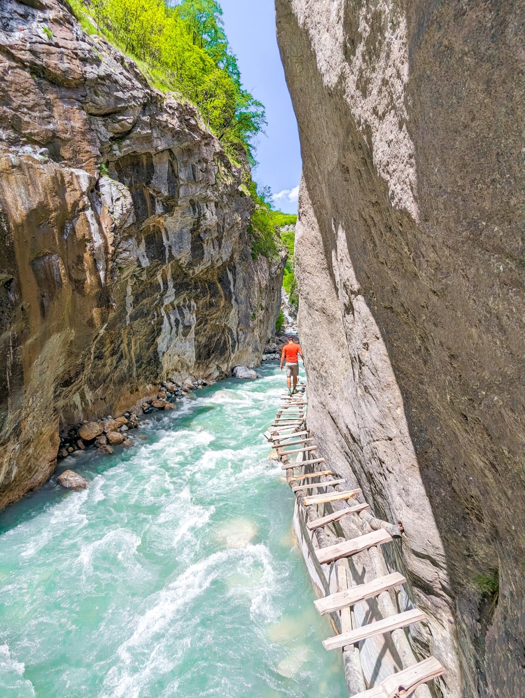
A hiker crosses a narrow wooden walkway above the Gashi River between steep gorge walls

The trail starts at the charming village of Begaj, which is nestled in the heart of the Albanian Alps. From there, you’ll begin your journey on a 10-kilometer-long trail that will take you through stunning landscapes, including the largest primary beech forest in the Albanian Alps, which is also a UNESCO World Heritage Site within the Primeval Beech Forests of the Carpathians and Other Regions of Europe.

About the Gashi River hike
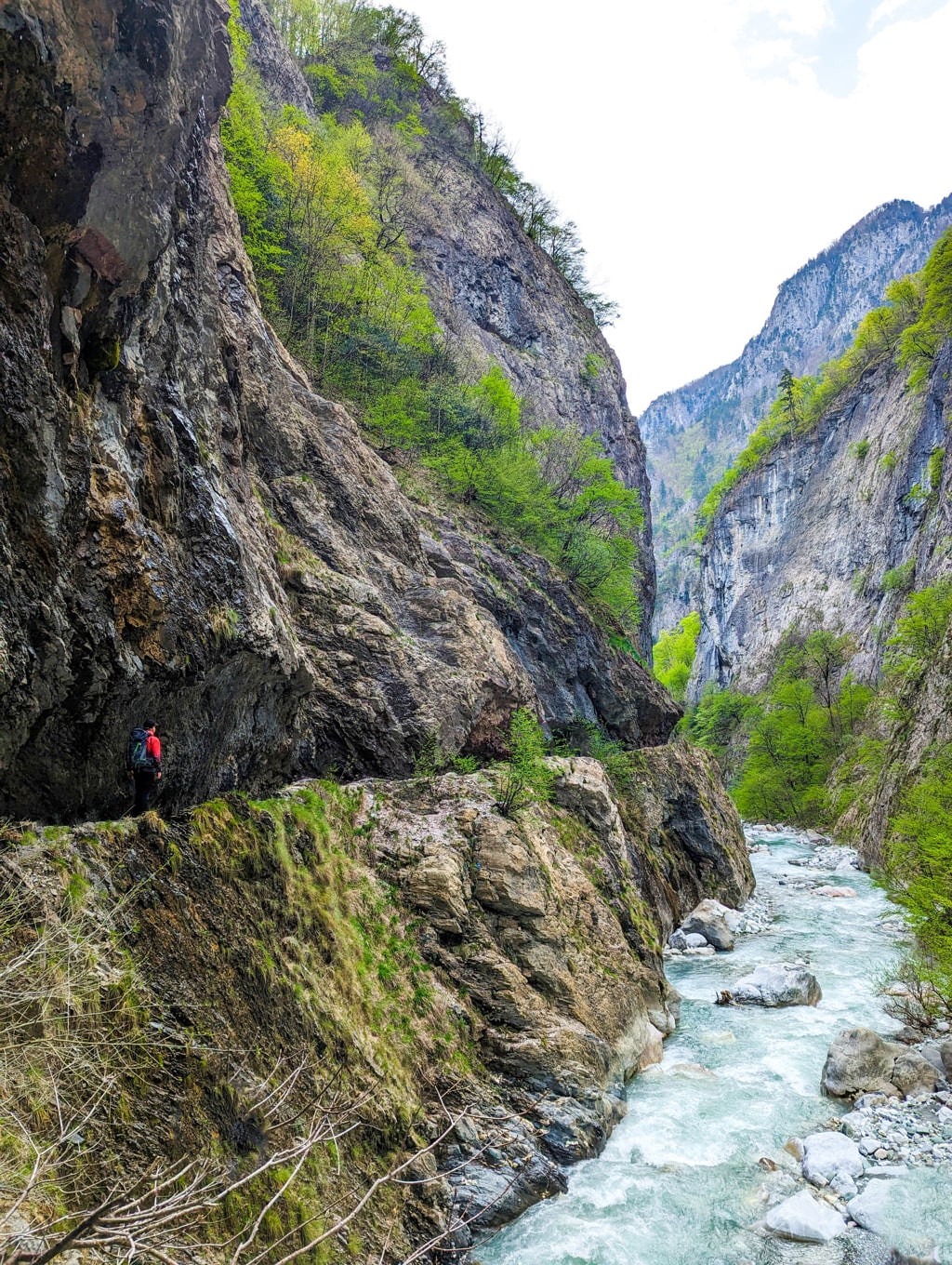
A hiker follows a narrow ledge above the rushing Gashi River between steep rocky canyon walls

The trail is relatively flat, with an elevation gain of only 220 meters and an elevation loss of the same amount, making it an excellent choice for beginners or those who prefer less strenuous hikes. Along the way, you’ll cross a few small streams and admire the stunning wildflowers and plants, including the Mediterranean, and endemic plant species, such as Heldreich’s pine (Pinus heldreichii), enhance the beech forest.

As you make your way through the trail, you’ll be rewarded with stunning views of the Gashi River, which characterizes the area with a deeply carved valley. The wild river is a nature reserve spanning an area of 3,000 hectares and offering a unique natural diversity of the Albanian Alps. You’ll see the beech forest scrambling high up on its steep slopes, and the fir tree marks the montane aspect.

The Gashi River is a sight to behold, and you’ll have the opportunity to take a refreshing dip in its crystal-clear waters or simply relax and take in the scenery. The river is stunning and holds historical significance, as it was an important trade route in the past.

Finally, the trail ends where you began, at the charming village of Begaj, where you can relax and immerse yourself in the local culture. You can indulge in traditional Albanian food and drink, interact with the locals, and learn more about this beautiful region’s fascinating history and customs.

In conclusion, hiking the trail to Gashi River from the village of Begaj in Tropoje, Albania, is an experience you should not miss. It offers an incredible combination of natural beauty, adventure, and cultural immersion, leaving you with unforgettable memories. So, pack your bags, put on your hiking boots, and head to this beautiful part of Albania for an adventure of a lifetime!

Points of interest:
Starting point: Begaj, Tropoje
Total distance: 20.5 km
Elevation gain: 210 m/alt
Share this guide

Questions and comments

15 comments

  1. Patrick Oonck

    Completely irresponsible to say this is an excellent choice for beginners.
    At a certain point we found ourselves at a small ledge with a 500 meter drop at one side. AVOID THIS TRAIL AT ALL COST!

    Reply

    1. Granit Author

      Hi Patrick,
      Thanks for the comment!

      Excellent choice for begginers since it has ONLY 200 meters elevation gain.

      Additionally, you can always use the river stream channel to avoid walking in the ledge.

      Reply

      1. Legion Of Doom

        Elevation is not everything when you have to walk over a 40 cm wide crumbling path.
        I REPEAT, TOO DANGEROUS and the directions to find it were crap too.

        Reply

        1. Granit Author

          Hi, you can always walk into the canal if you find it dangerous.

          Reply

  2. Nebojsa

    this looks very appealing, when did you go? late may or begin of june?
    keep on doing great job, granit. greetings.

    Reply

    1. Granit Author

      Thank you so much man!

      I went twice this year. End of April, and mid May.

      Reply

  3. Mike

    Hey 🙂 Can u provide info where we can find those wooden steps? I mean is it closer to Begaj, or at the end? 🙂

    Reply

    1. Granit Author

      Hi, it is at the end.

      Reply

  4. Vanessa

    Hi, I am looking to follow this hiking route in September. How is the easiest way to reach the start without a car? I’ll be coming from Valbona and was wondering if it is possible to cut across hiking or if I need to go all the way down to Bajram Curri first?
    Thanks so much!

    Reply

    1. Granit Author

      Hi Vanessa, to be honest, in Albania you should definitely have a car, or at least take a taxi. I think from Bajram Curri, you can find a lot of taxis.

      Reply

  5. Michał

    Hi Granit,

    Is there a parking area where we can leave our car? The village of Begaj looks very remote and I wasn’t able to find any spot. I’m only thinking about the restaurant – maybe they will allow to leave the car for couple of hours.

    Thanks a lot!
    Michał

    Reply

  6. Ilir D.

    Thanks for the kind words about Begaj. It’s the village of my ancestor’s and luckily my family still has land there. Safe travels!

    Reply

  7. Nora

    We tried doing this route today and I have to agree with the other commenters. This is insanely risky, there are crazy drops on the side, it is super hard to find Begaj, and there are no paved roads to get there. We stopped after a mile and went back, and we’re very experienced hikers.

    Reply

  8. Geoff

    Hi. Where can I find similar to Ordance Survey maps for hiking for this region please. Great blog, got us very interested in the walk but want to have paper maps not rely on technology.
    Thank you

    Reply

Leave a comment or a trail report

Your email is never shown. A first comment appears once I have read it.

Trail report

Through my lens

More from Albania

All my photographs

Keep exploring

More from Accursed Mountains

All Albania guides
Granit Temaj

Get my new stories by email

Be the first to know when I come back from the mountains with a new route.

You will get one email to confirm. Unsubscribe any time. Privacy

Read the guide

Trail alerts

An email when someone reports how the path is, or when I update the guide. Nothing else, and one click stops it.

You confirm it by email first. Your address is used for these alerts only. Privacy

License this photograph

Tell me what it is for. I answer within a few days with a price and the licence.

Your name and email are used only to answer this request.

Newsletter

Get my new stories by email

Be the first to know when I come back from the mountains with a new route.

You will get one email to confirm. Unsubscribe any time. Privacy