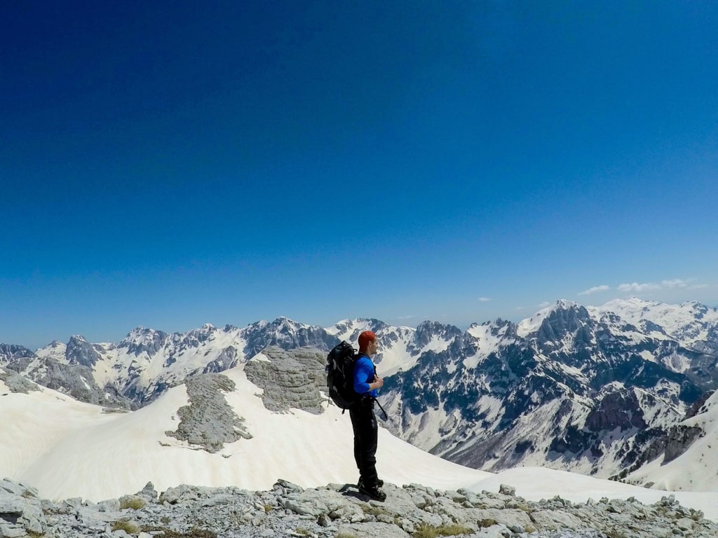
Maja e Popluks (also called Maja e Poplukës, Papluka, Popljuces) is barely visible from either valley but appears when climbing Qafa e Pejes or Qafa e Valbones. Papluka offers magic views in all directions but is often overlooked by hikers who most of the time only aim at Jezerca. In this blog, I will explain hiking from Valbona Valley to Popluka peak.
How to get to Valbona Valley National Park
Valbona Valley is 22 km from the city called Bajram Curri. Reaching Bajram Curri from Tirana takes around four hours. The bus station in Tirana is in front of Asllan Rusi Sports Center.
Another way to reach Bajram Curri is from Prishtina, Kosovo. First, you go from Prishtina Main Bus Station to Gjakova Bus station and then from Gjakova take the bus to Bajram Curri.
Where to sleep and eat
In Valbona Valley there are a lot of Guesthouses, which are cheap, traditional, cozy and they serve you very delicious food. During the summer, the Guesthouses are usually full of tourists, so make sure to book them early.
About the Valbona to Maja e Popluks hike
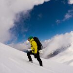
It takes around 10 hours reaching the summit (around 11 during the winter). It would be great if you have your helmet, cause during all the paths you will have rocks. Also, you may need the crampons and ice axe in some places all year. Usually, you can climb this peak all year, but in some places, it is very dangerous, especially during the winter.
You start this hike from Fusha e Gjes in Valbona Valley, through Rrogam (a small village) then you will have a bar, called “Te Simoni” and there you have the last water source in the spring. After you leave a mini bar called “Te Simoni” you follow the trail until you see a small sign where you choose the left path to go to a village called Theth (Valbone – Theth) or the right to Popluka peak.
You follow the path but make sure you don’t mix the road to another peak near Popluka (Jezerca Peak).
Points of interest:
Starting point: Fusha e Gjes’, Valbona
Starting altitude: 949 m/alt
Highest altitude: 2’569 m/alt
Elevation gain: 1’620 m/alt
Check out the wikiloc trail, you can download and follow it:
Accursed Mountains Hiking Mountains Prokletije
Last modified: October 9, 2025
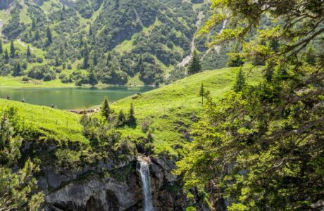


[…] Maja e Popluks (also called Maja e Poplukës, Papluka, Popljuces) is barely visible from either valley but appears when climbing Qafa e Pejes or Qafa e Valbones. You start this hike from Fusha e Gjes in Valbona Valley, through Rrogam (a small village) then you will have a bar, called “Te Simoni” and there you have the last water source in the spring. After you leave the mini bar called “Te Simoni” you follow the trail until you see a small sign where you choose the right path to Popluka peak. The last part of the trail offers you magical views of the Valbona Valley. For more: Maja e Popluks […]
[…] way to the top. However, be sure not to confuse the trail with another peak near Jezerca, known as Popluka Peak. With proper preparation and attention to detail, the summit of Maja Jezerce can be an […]