Theth and Nderlysa, the isolated villages of Albania

· updated · 2 min read
Stone church in Theth beneath rugged Albanian Alps, with a tall tree and flowered meadow in summer light
Theth and Nderlysa, Albania

Where it is

Theth and Nderlysa, on the map

What to pack15 things, for nights on the way

Every hike

Nights on the way

The light for photographs

Today at the high point: sunrise 06:12, sunset 16:36.

Today at the high point: sunrise 06:12, sunset 16:36.

At the high point, in local time (Europe/Tirane), with an open horizon: the mountains around can hide the sun sooner.

In short

Theth and Nderlysa are villages in Albania’s Accursed Mountains, with guesthouses and sights including Grunas Waterfall and Blue Eye spring. From Theth Center, Nderlysa is 8 km away along an unpaved road. You can hike there or take a taxi.

Theth and Nderlysa, are the most beautiful and isolated villages of the Accursed mountains (Prokletije), therefore the last years they have become famous destinations for outdoor enthusiasts from all around the world.

How to get to Theth and Nderlysa

There are two ways to go to Theth and Nderlysa:

From Shkodra

During the summer you have minibuses which travel every morning (around 7 a.m) from Rus in Shkodra.

The minibus goes from Shkodra to Koplik where you can find a supermarket. 70% of the road is unpaved and it takes 3-4 hours to arrive in the Theth village, along the road the views are great.

From Valbona

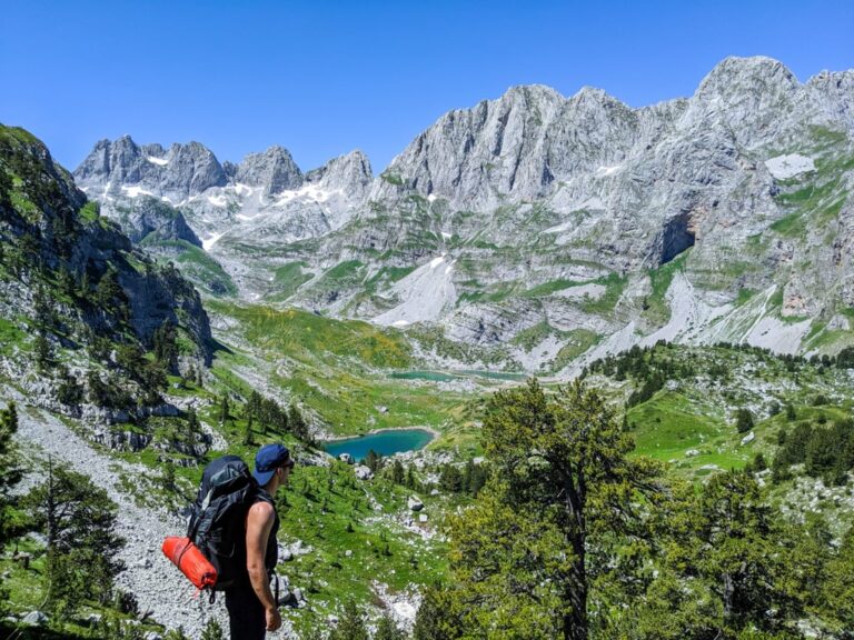
A hiker overlooks the green Valbona Valley and rugged peaks beneath a cloudy sky

If you want to hike in one of the most beautiful paths in Albania, probably you need to hike from Valbona to Theth.

Check this trail: Valbona to Theth

Where to eat and sleep

There are a lot of Guesthouses in Theth. Cheap, traditional, cozy and they serve you very delicious food. During the summer, the Guesthouses are usually full of tourists, therefore make sure to book them early.

I think now you have a mini market too, which is located in Theth Center.

Top places

Kulla e ngujimit (Lock-in Tower) and Church of Theth are two most visited destinations. Kulla e ngujimit is a historical destination, very important for the locals and shows how mountain men were trying to avoid the blood feud.

A great outdoor destination is definitely Grunas waterfall, check out the picture:

A hiker stands beneath Grunas Waterfall in Theth, surrounded by steep rocky cliffs

Follow the trail from Theth Center to Grunas waterfall:

Theth – Grunas Waterfall – Theth6.2 km · +177 m · −190 m · 801 m high · about 2 h walking
Elevation
Elevation profile of Theth and Nderlysa, the isolated villages of AlbaniaStarts at 771 m, climbs 177 m in total to a high point of 801 m after 3.2 km, and finishes at 757 m; 6.2 km in all.700 m800 m0 km1 km2 km3 km4 km5 km6 kmStart & finishHigh point · 801 m

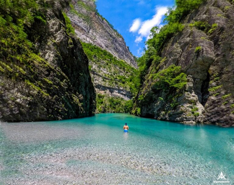
Another destination is Nderlysa village, where you can find the canyon with so many beautiful natural pools, and Blue eye spring as well.

You can hike for a day, or pay for a taxi from Theth center, the total distance from Theth center to Nderlysa is 8 km, through an unpaved road.

In Nderlysa you can find great Guesthouses too. In my opinion, the Guesthouse called “Bjeshka” is the best one there.

You can go from Theth to Grunas waterfall and then through a sheep path to Nderlysa:

Check out the trail from Theth Center – Grunas Waterfall – Nderlysa:

Theth – Grunas Waterfall – Nderlysa7.0 km · +134 m · −402 m · 817 m high · about 2 h 20 min walking
Elevation
Elevation profile of Theth and Nderlysa, the isolated villages of AlbaniaStarts at 790 m, climbs 134 m in total to a high point of 817 m after 3.2 km, and finishes at 522 m; 7.0 km in all.600 m800 m0 km1 km2 km3 km4 km5 km6 kmStartHigh point · 817 mFinish

Trail from Nderlysa to Blue Eye:

Nderlysaj – Vaskat – Blue Eye6.1 km · +391 m · −300 m · 689 m high · about 2 h 40 min walking
Elevation
Elevation profile of Theth and Nderlysa, the isolated villages of AlbaniaStarts at 543 m, climbs 391 m in total to a high point of 689 m after 3.7 km, and finishes at 634 m; 6.1 km in all.600 m700 m0 km1 km2 km3 km4 km5 km6 kmStart & finishHigh point · 689 m

Share this guide

Questions and comments

Ask me about this hike

Leave a comment or a trail report

Your email is never shown. A first comment appears once I have read it.

Trail report

Through my lens

More from Albania

All my photographs

Keep exploring

More from Accursed Mountains

All Albania guides
Granit Temaj

Get my new stories by email

Be the first to know when I come back from the mountains with a new route.

You will get one email to confirm. Unsubscribe any time. Privacy

Read the guide

Trail alerts

An email when someone reports how the path is, or when I update the guide. Nothing else, and one click stops it.

You confirm it by email first. Your address is used for these alerts only. Privacy

License this photograph

Tell me what it is for. I answer within a few days with a price and the licence.

Your name and email are used only to answer this request.

Newsletter

Get my new stories by email

Be the first to know when I come back from the mountains with a new route.

You will get one email to confirm. Unsubscribe any time. Privacy