Prepare for an exciting alpine journey as we take you on a mountain hike to the stunning Schafreuter summit. This moderately challenging hike offers breathtaking vistas, diverse terrains, and a chance to explore the natural beauty of the Bavarian Alps. With wide forest paths, meadow trails, and exhilarating scrambles, this adventure promises both thrill and awe. So, lace up your hiking boots, and let’s embark on an unforgettable exploration of the Schafreuter Peak.
How to get there
If you’re driving, follow these directions: Take the Munich-Salzburg motorway and exit at Holzkirchen. Drive through Holzkirchen, Bad Tölz, and continue towards Sylvenstein. At the Sylvenstein reservoir dam, turn right towards Vorderriß, and in Vorderriß, turn left towards Hinterriß. After 4.5 km, you’ll pass the Oswaldhütte. Just 400 meters ahead, before reaching the state border, you’ll find the starting point for the Schafreuter hike on the left side of the road. Look for the yellow signpost “Schafreuter, Tölzer Hütte.” Park on the right side of the road at the entrance.
For those using public transport, take the Bavarian Regiobahn from Munich to Lenggries. From there, board the mountaineering bus (line 9569, available from May to October) heading towards Eng to reach the Oswaldhütte Lenggries stop. The bus stop is just a 5-minute walk from the starting point.
About the Schafreuter Hike
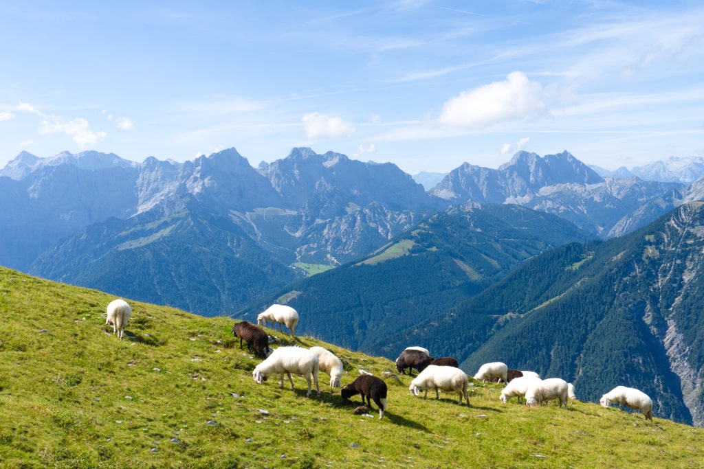
Starting at the Riißtal car park, we follow a forest road southward, passing through a sparse forest and reaching an unsigned fork after a barrier. Here, we choose the left (upper) path, following the forest road uphill in several serpentines. After about an hour, we cross a pasture grate, and later, in a left bend, we encounter another unsigned junction, opting to continue straight ahead. After passing a small wooden hut, we arrive at a turning point, from where we embark on a cart path, descending gently into a depression. We turn right in front of a signpost and a group of trees, following the meadow path to a grassy ridge scattered with stones. We traverse the ridge in an easterly direction, enjoying the stunning views.
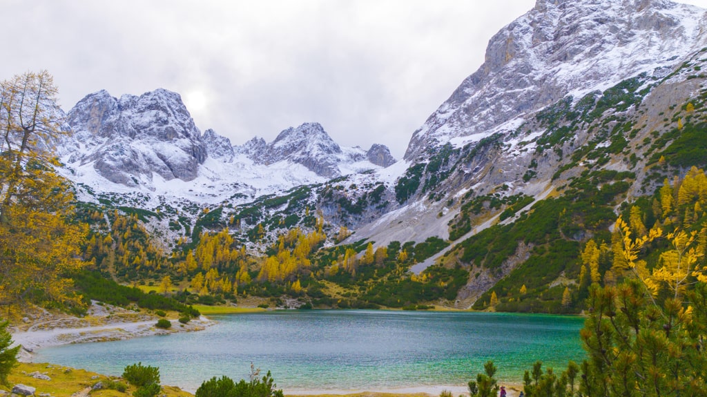
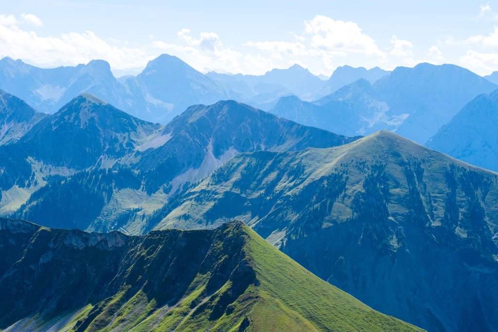
The Schafreuter, standing at the Bavaria-Tyrol border, offers panoramic views of the Karwendel main ridge and the Bavarian Prealps. To reach the summit, we’ll climb a total of 1200 meters in altitude.
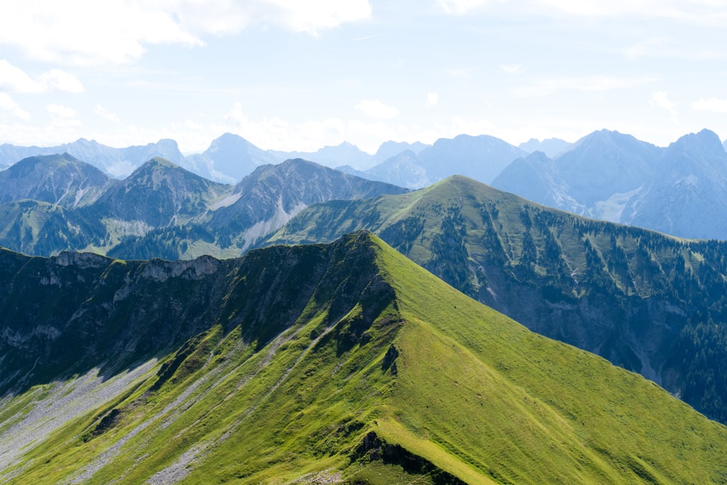
After the summit, we retrace our steps for a short distance, turn left on the ridge in a small notch, and follow the red and white markings downhill to a rope-secured steep step. Here, we descend the rock step along the wire rope, making use of the step aid provided. We continue zigzagging down over Schrofen and reach the ridge of the south-west foothills. Following the ridge, we arrive at a broader ridge adorned with numerous cairns. We then follow the course of the ridge briefly and turn right, keeping slightly to the right.
The descent from the Schafreuter to the Tölzer Hütte (1825 m) is more demanding than the ascent, featuring smaller scrambles secured with wire ropes. In wet conditions, the rugged and flat paths in the summit area can be slippery. This hike requires a head for heights and surefootedness.
To return to the Rißtal, we head left past the hut and turn left at the house wall. Descending to a path, we follow it westward to a lift mast of the material cable car. After passing the mast, we hike below the Schafreuter summit and descend into a valley filled with mountain pines. From the depression, we climb up to the southwest ridge in a counter-ascent of 50 meters in altitude. On reaching the wide ridge, we turn right and follow the markings along a partly indistinct meadow path, leading to a moderate loss of altitude. We continue following the good markings through a light forest, cross the state border between Tyrol and Bavaria, and hike through some mountain pine fields.
The Schafreuter summit hike promises an exhilarating mountain adventure with stunning vistas and a mix of terrains. From wide forest paths to meadow trails and entertaining scrambles, this hike has it all. Ascend the Schafreuter and savor the unmatched beauty of the Bavarian Alps. This journey is ideal for hikers with a head for heights and surefootedness. It’s time to elevate your hiking experience and create lasting memories.
Points of Interest:
- Starting Point: Riißtal Car Park (47.518052, 11.443811)
- Total Distance: 16 km
- Starting Altitude: 850 m
- Highest Altitude: Schafreuter (2102 m)
- Elevation Gain: 1270 m
Here is the Wikiloc trail:
You can buy me a beer to support me and my content! 🍺
Bavaria Bavarian Alps Forest Hiking Karwendel Mountains
Last modified: September 22, 2025