Embark on a journey to the Aggenstein, a gem nestled in the heart of the Tannheimer Tal, where the beauty of the Austrian Alps unfolds at every turn. This hike is not just a walk in the mountains; it’s an exploration of alpine meadows, a traverse through lush forests, and a climb alongside rushing streams, culminating in a breathtaking summit experience. Whether you’re an avid hiker looking for your next challenge or a nature lover seeking serene landscapes, the Aggenstein hike offers a unique blend of natural beauty and adventurous paths. Let’s lace up our boots and set out on an adventure that promises unforgettable views and heartwarming moments.
How to Get There
By Car: Starting your adventure from Garmisch, take the scenic route via Leermos to reach the Aggenstein trailhead. If you’re coming from Innsbruck, the Fern Pass route through Reutte is your gateway to this alpine paradise. Upon reaching Reutte, continue to Weißenbach, then turn right into the enchanting Tannheimer Tal. After passing the picturesque areas of Haller and Haldensee, a right turn at Grän will lead you to the dedicated parking area for the Bad Kissinger Hütte, just beyond the town’s limits. For those approaching from Pfronten towards the Tannheimer Tal, the hiking car park is conveniently located on the left, just before Grän.
Geo Coordinates: For those who prefer precision, the starting point at Grän can be found at 47.515078, 10.556091. Input these coordinates into your GPS, and you’re on your way to an unforgettable hiking experience.
About the Aggenstein Hike

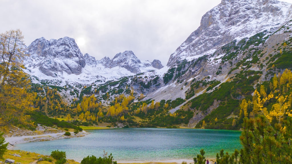
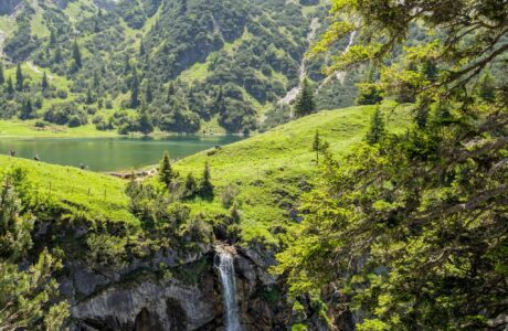
Character: The journey to Aggenstein is a thrilling blend of moderate and demanding paths, leading hikers through diverse terrains. The trail meanders through sparse forests and vibrant meadows, alongside babbling streams, up to the striking Bad Kissinger Hut. The real adventure begins as the path narrows, and a short scramble assisted by an iron chain awaits near the summit. This section requires surefootedness and a steady hand but rewards hikers with unparalleled views and a sense of achievement.
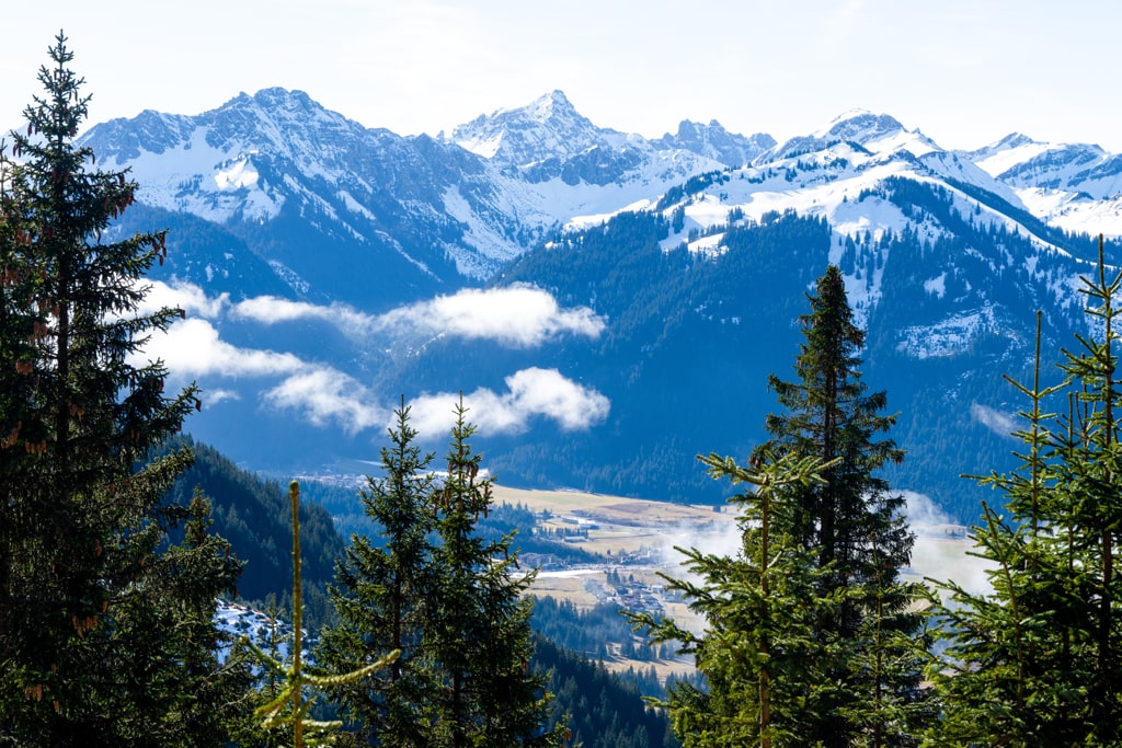
The Ascent: The hike commences from the parking lot, where a wide road directs you towards the Aggenstein, with clear signs marking the way. A right turn past a small cluster of houses leads onto a field path, guiding hikers past a radio mast and into the embrace of a sparse forest. Crossing two wooden bridges over streams, the trail gradually steepens, eventually opening up to offer stunning vistas of the Tannheimer Valley. The path to the Bad Kissinger Hütte is a rewarding climb, with the final approach to the Aggenstein summit presenting a memorable climb through a gully, assisted by an iron chain for added safety and support.
Summit Experience: Upon reaching the summit area, the panoramic views are truly awe-inspiring. Gazing out over the Ammergau, Tannheim, Lechtal, and Allgäu mountains, with Füssen and the Tannheimer valley below, is a moment to savor. The journey challenges and rewards in equal measure, offering a profound connection to the natural world.
The hike to Aggenstein is more than just a mountain trail; it’s an invitation to immerse yourself in the breathtaking beauty of the Austrian Alps. With its varied terrain, challenging climbs, and stunning panoramas, it stands as a testament to the allure of alpine hiking. Whether you seek the thrill of the ascent or the tranquility of alpine meadows, this hike offers a rich tapestry of experiences. So, as you reflect on this guide and prepare for your journey, remember that the path to Aggenstein is not just about reaching a physical location. It’s about discovering the spirit of adventure that lies within us all, beckoning us towards the peaks and the profound beauty that awaits.
Points of interest:
Starting point: Enge (47.515078, 10.556091)
Total distance: 9.4 km
Elevation gain: 915 m
Highest peak: Aggenstein (1’986 m)
Here is the wikiloc trail:
You can buy me a beer to support me and my content! 🍺
Last modified: September 22, 2025