Maja e Rosit (Rosni Vrh) 2524 m/alt, Albania

· updated · 2 min read
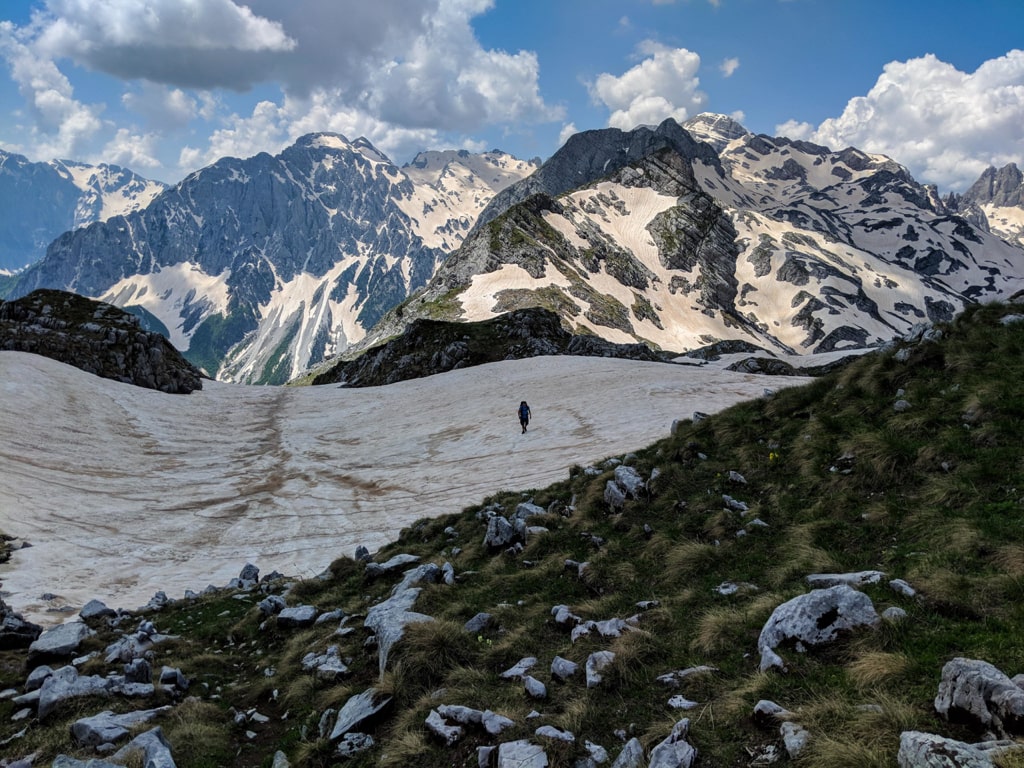
A hiker crosses a snowy slope below the rugged peaks of Maja e Rosit in the Albanian Alps
Maja e Rosit (Rosni Vrh) 2524 m/alt, Albania
Distance
16.5 km
Time
8 h
Ascent
+1,605 m
Descent
−1,546 m
High point
2,525 m
Difficulty
Challenging

The route

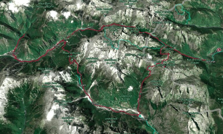
Maja e Rosit (Rosni Vrh) 2524 m/alt, on the map

From my own GPX track. Move along the elevation profile or along the line on the map: both show the same point.

Distance16.5km
Time8 h
Ascent+1,605m
Descent−1,546m
High point2,525m
DifficultyChallenging

Walking time at your paceAn estimate without breaks, worked out from the distance and the climb.

  • Relaxed13 h 10 min
  • Average10 h 30 min
  • Fast8 h 25 min

Elevation

Elevation profile of Maja e Rosit (Rosni Vrh) 2524 m/alt, AlbaniaStarts at 952 m, climbs 1,605 m in total to a high point of 2,482 m after 8.4 km, and finishes at 968 m; 16.5 km in all.1,000 m2,000 m0 km2 km4 km6 km8 km10 km12 km14 km16 kmFusha e Gjes’, ValbonaMaja e Rosit (Rosni Vrh) · 2,482 mFinish

How steep

  • 2.6 kmUnder 8%
  • 5.1 km8 to 15%
  • 4.3 km15 to 25%
  • 4.4 kmOver 25%

In two parts

Embed this map

Paste this into your page or post (in WordPress: a Custom HTML block). The map stays up to date with the guide, and the link under it leads your readers to the full guide.

What to pack14 things, for a summit, a long day

Every hike

For the summit

For a long day

The light for photographs

Today at Maja e Rosit (Rosni Vrh): sunrise 06:12, sunset 16:35.

Today at Maja e Rosit (Rosni Vrh): sunrise 06:12, sunset 16:35.

At Maja e Rosit (Rosni Vrh), 2,482 m, in local time (Europe/Tirane), with an open horizon: the mountains around can hide the sun sooner.

In short

Maja e Rosit is a summit on the Albania-Montenegro border, reached on a hike from Fusha e Gjes’ in Valbona. The 16.5 km hike takes about 8 hours, gains 1,605 m and reaches 2,525 m. The last water source is in Kukaj, so carry 2 to 2.5 litres.

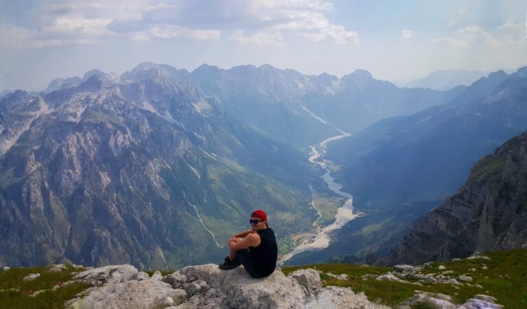
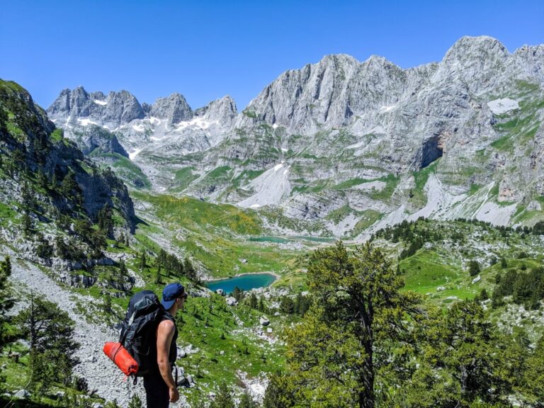
Maja e Rosit (Rosni Vrh) is the 15th highest peak of the Accursed Mountains (Prokletije). It is also called as “Maja e Roshit” and “Rosni Peak“. Located on the border between Albania and Montenegro it’s a perfect hiking peak. During the hike, you can see and enjoy the view of Valbona Valley, Maja e Thate peak, Maja Jezerca peak, Karanfilat range of peaks, Vajusha peak etc. So, the view during the hike is 360 degrees and magic.

A hiker crosses a snowy slope below the rugged peaks of Maja e Rosit in the Albanian Alps

How to get to Valbona Valley National Park

Valbona Valley is 22 km from the city called Bajram Curri. Reaching Bajram Curri from Tirana takes around four hours. The bus station in Tirana is in front of Asllan Rusi Sports Center. 

Another way to reach Bajram Curri is from Prishtina, Kosovo. First, you go from Prishtina Main Bus Station to Gjakova Bus station and then from Gjakova take the bus to Bajram Curri.

Where to sleep and eat

In Valbona Valley there are a lot of Guesthouses, which are cheap, traditional, cozy and they serve you very delicious food. During the summer, the Guesthouses are usually full of tourists, so make sure to book them early. 

About the Maja e Rosit hike

A hiker on the rocky summit of Maja e Rosit looks across rugged mountains in Albania and Montenegro

The hike to Maja e Rosit (Rosni Vrh) starts from the Valbona National Park, near the school. You take the path to Kukaj village, where you can find the last water source. You need around 2-2.5 liters of water for this hike. After around 5 km of hiking, you can see one shepherd house which is residential during the summer. Shepherd houses are always open for the hikers, and you can stay there in case of rain or anything.

The total time for this hike and back is around 8 hours.

The view from the top is breathtaking. Check it out:

Points of interest: 
Starting point: Fusha e Gjes’, Valbona
Starting altitude: 947 m/alt
Highest altitude: 2’525 m/alt
Elevation gain: 1’605 m/alt
Share this guide

Questions and comments

Ask me about this hike

Leave a comment or a trail report

Your email is never shown. A first comment appears once I have read it.

Trail report

Through my lens

More from Albania

All my photographs

Keep exploring

More from Accursed Mountains

All Albania guides
Granit Temaj

Get my new stories by email

Be the first to know when I come back from the mountains with a new route.

You will get one email to confirm. Unsubscribe any time. Privacy

Read the guide

Trail alerts

An email when someone reports how the path is, or when I update the guide. Nothing else, and one click stops it.

You confirm it by email first. Your address is used for these alerts only. Privacy

License this photograph

Tell me what it is for. I answer within a few days with a price and the licence.

Your name and email are used only to answer this request.

Newsletter

Get my new stories by email

Be the first to know when I come back from the mountains with a new route.

You will get one email to confirm. Unsubscribe any time. Privacy