For the trail · alpventurer.com/maja-e-rosit
Maja e Rosit (Rosni Vrh) 2524 m/alt, Albania
Maja e Rosit (Rosni Vrh) 2524 m/alt · Albania
- Time
- 8 h
- Difficulty
- Challenging
- Water
- Last source in Kukaj; carry 2–2.5 litres
- Parking
- Free
In short
Maja e Rosit is a summit on the Albania-Montenegro border, reached on a hike from Fusha e Gjes’ in Valbona. The 16.5 km hike takes about 8 hours, gains 1,605 m and reaches 2,525 m. The last water source is in Kukaj, so carry 2 to 2.5 litres.
The route
- Distance
- 16.5 km
- Ascent
- +1,605 m
- Descent
- −1,546 m
- High point
- 2,525 m
- Lowest point
- 950 m
A Fusha e Gjes’, Valbona: 42.45021, 19.88851B Finish: 42.44530, 19.88109▲ Maja e Rosit (Rosni Vrh): 42.47946, 19.85049
Walking time, without breaks
- Relaxed13 h 10 min
- Average10 h 30 min
- Fast8 h 25 min
How steep
- Under 8% 2.6 km
- 8 to 15% 5.1 km
- 15 to 25% 4.3 km
- Over 25% 4.4 km
In two parts
- Up to Maja e Rosit (Rosni Vrh) 8.4 km · +1,553 m
- Down to the finish 8.1 km · −1,528 m
What to pack
Every hike
- Water: about 3.5 litres (half a litre an hour)
- Rain jacket
- A warm layer (fleece or light down)
- Sun cap, sunglasses and sun cream
- Boots or trail shoes with good grip
- Phone with the map offline, and a power bank
- Small first aid kit
- Headlamp, in case it gets late
- Some cash and your ID
For the summit
- Hat and gloves: it is colder and windier at the top
- Walking poles, for the way down
For a long day
- Lunch, and a snack for every two hours
- Salty snacks or electrolytes
- Blister plasters
The guide
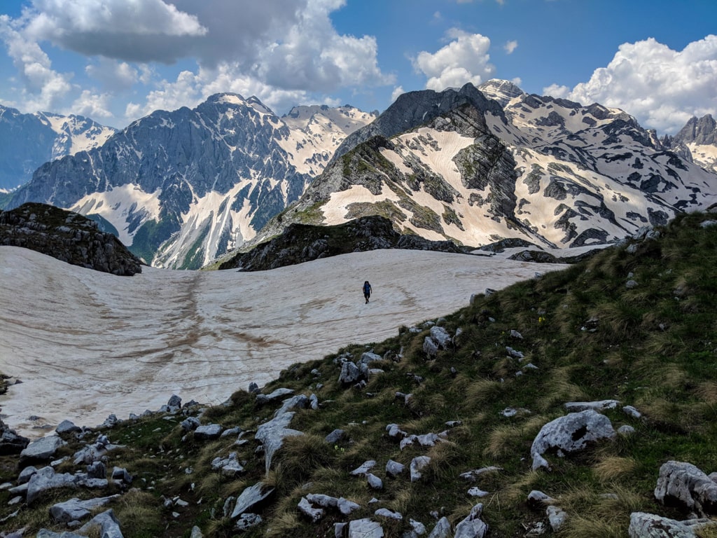
Maja e Rosit (Rosni Vrh) is the 15th highest peak of the Accursed Mountains (Prokletije). It is also called as “Maja e Roshit” and “Rosni Peak“. Located on the border between Albania and Montenegro it’s a perfect hiking peak. During the hike, you can see and enjoy the view of Valbona Valley, Maja e Thate peak, Maja Jezerca peak, Karanfilat range of peaks, Vajusha peak etc. So, the view during the hike is 360 degrees and magic.
How to get to Valbona Valley National Park
Valbona Valley is 22 km from the city called Bajram Curri. Reaching Bajram Curri from Tirana takes around four hours. The bus station in Tirana is in front of Asllan Rusi Sports Center.
Another way to reach Bajram Curri is from Prishtina, Kosovo. First, you go from Prishtina Main Bus Station to Gjakova Bus station and then from Gjakova take the bus to Bajram Curri.
Where to sleep and eat
In Valbona Valley there are a lot of Guesthouses, which are cheap, traditional, cozy and they serve you very delicious food. During the summer, the Guesthouses are usually full of tourists, so make sure to book them early.
About the Maja e Rosit hike

The hike to Maja e Rosit (Rosni Vrh) starts from the Valbona National Park, near the school. You take the path to Kukaj village, where you can find the last water source. You need around 2-2.5 liters of water for this hike. After around 5 km of hiking, you can see one shepherd house which is residential during the summer. Shepherd houses are always open for the hikers, and you can stay there in case of rain or anything.
The total time for this hike and back is around 8 hours.
The view from the top is breathtaking. Check it out:
Points of interest:
Starting point: Fusha e Gjes’, Valbona
Starting altitude: 947 m/alt
Highest altitude: 2’525 m/alt
Elevation gain: 1’605 m/alt