Bogova Waterfall, beautiful exotic destination near Berat

· updated · 1 min read
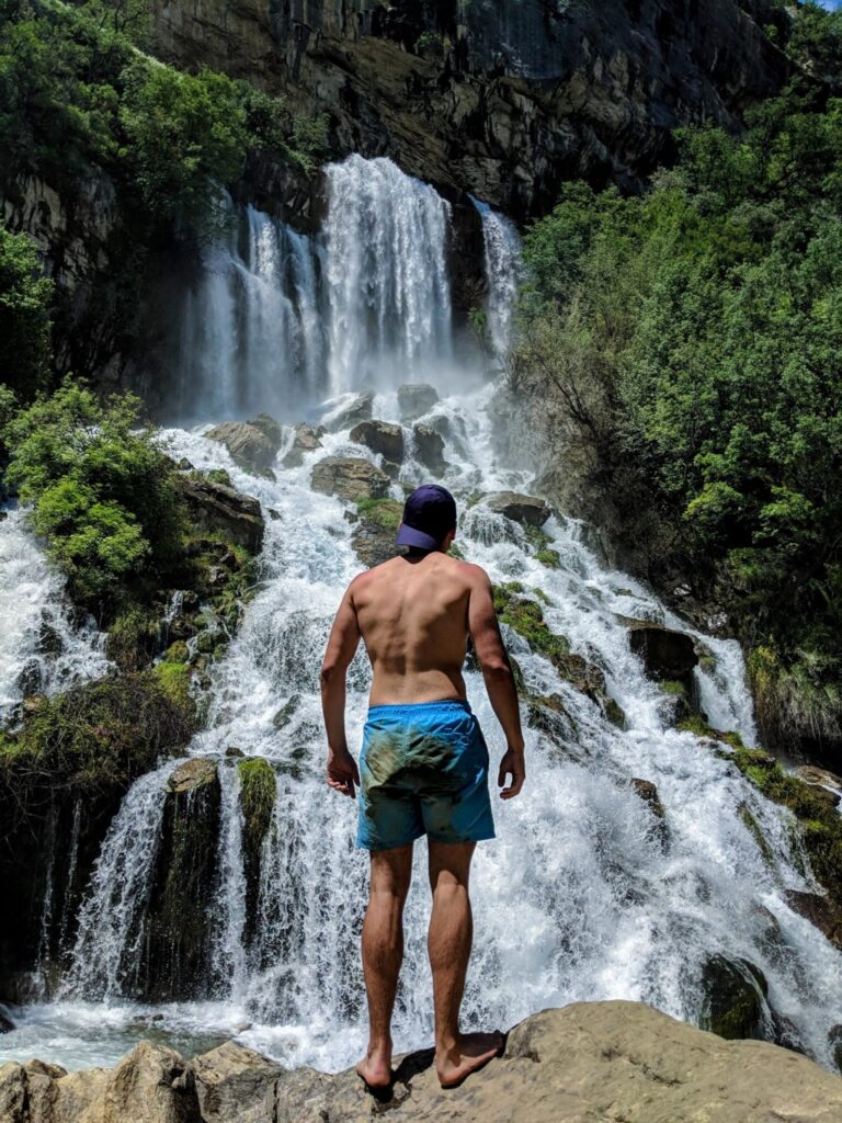
Bogova Waterfall drops between pale rocky cliffs into a turquoise pool where a swimmer floats
Bogova Waterfall, Albania
Distance
5.5 km
Ascent
+176 m
Descent
−7 m
High point
348 m
Difficulty
Easy
Season
Spring

The route

Bogova Waterfall, on the map

From my own GPX track. Move along the elevation profile or along the line on the map: both show the same point.

Distance5.5km
Ascent+176m
Descent−7m
High point348m
DifficultyEasy

Walking time at your paceAn estimate without breaks, worked out from the distance and the climb.

  • Relaxed2 h 5 min
  • Average1 h 40 min
  • Fast1 h 20 min

Elevation

Elevation profile of Bogova Waterfall, beautiful exotic destination near BeratStarts at 231 m, climbs 176 m in total to a high point of 348 m after 2.5 km, and finishes at 347 m; 2.7 km in all.250 m300 m350 m0.0 km0.5 km1.0 km1.5 km2.0 km2.5 kmBogovaFinish

How steep

  • 2.2 kmUnder 8%
  • 0.4 km8 to 15%
  • 0.0 km15 to 25%
  • 0.0 kmOver 25%

Embed this map

Paste this into your page or post (in WordPress: a Custom HTML block). The map stays up to date with the guide, and the link under it leads your readers to the full guide.

What to pack10 things for this hike

Every hike

The light for photographs

Today at Bogova Waterfall: sunrise 06:08, sunset 16:37.

Today at Bogova Waterfall: sunrise 06:08, sunset 16:37.

At Bogova Waterfall, 348 m, in local time (Europe/Tirane), with an open horizon: the mountains around can hide the sun sooner.

In short

Bogova Waterfall is reached on an easy 5.5 km hike from the village of Bogova, near Berat, Albania. The route gains 176 m and is best in spring, when snowmelt increases the water flow. The waterfall water is cold, and food and drinks are available in Bogova.

Looking for an exotic outdoor destination in Albania? Bogova waterfall for sure is part of this list. Located in Skrapar municipality, Berat country,  is a great day trip outdoor destination.

How to get to Bogova

If you are driving from Tirana, you need to take the highway to Lushnje direction, and then Berat direction. Berat is a great city, part of UNESCO, as a rare example of an architectural character typical of the Ottoman period. You may combine visiting Berat and an easy hike to the Bogova waterfall.

When you arrive in Berat, you have to take the road to Poliçan. The distance from Tirana to Bogova is 131 km, and it takes around 2h and 30 mins, and from Berat to Bogova, 35 km, and it takes 1 hour.

Bogova Waterfall drops between pale rocky cliffs into a turquoise pool where a swimmer floats

What to eat, and about Bogova Waterfall hike

Definitely, the best season to go there is spring. Because of the snowmelt, the water capacity significantly increases. The hike starts from the village of Bogova, where you can find a lot of local restaurants and mini-markets where you can find food and drinks. In Bogova, there is a parking spot, where you can park the car. 

The hike starts through an unpaved road until you reach Roi Bogova, Water park. From there, you take right, through a well-signed trail. In two places, you will need to cross the wooden bridges. All the hike is through the forest by the river, which flows from the beautiful Tomorri mountain.

After 2.7 km, you will reach the beautiful waterfall of Bogova. The total distance is 5.5 km round-trip.

The water in the waterfall is cold, and much needed after this hike. You have to try it!

Elevation gain: 176 m/alt

Maximum elevation: 348 m/alt

Minimum elevation: 229 m/alt
Share this guide

Questions and comments

Ask me about this hike

Leave a comment or a trail report

Your email is never shown. A first comment appears once I have read it.

Trail report

Through my lens

More from Albania

All my photographs

Keep exploring

More from Albania

All Albania guides
Granit Temaj

Get my new stories by email

Be the first to know when I come back from the mountains with a new route.

You will get one email to confirm. Unsubscribe any time. Privacy

Read the guide

Trail alerts

An email when someone reports how the path is, or when I update the guide. Nothing else, and one click stops it.

You confirm it by email first. Your address is used for these alerts only. Privacy

License this photograph

Tell me what it is for. I answer within a few days with a price and the licence.

Your name and email are used only to answer this request.

Newsletter

Get my new stories by email

Be the first to know when I come back from the mountains with a new route.

You will get one email to confirm. Unsubscribe any time. Privacy