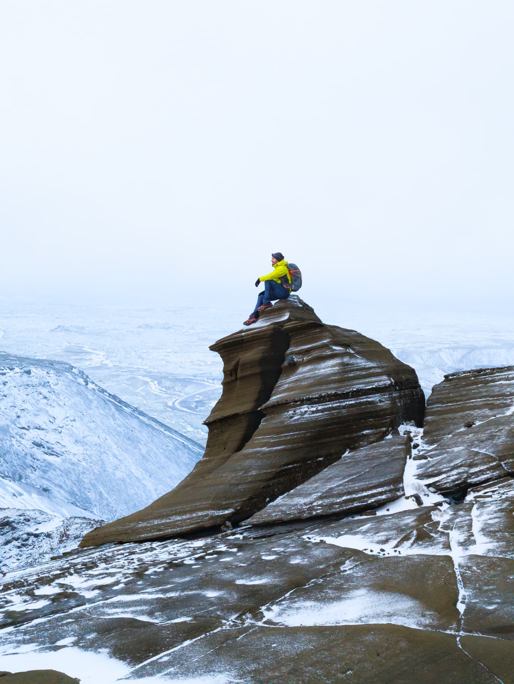
Just outside Reykjavík, Vífilfell rises quietly from the lava plains — a compact, steep mountain shaped by subglacial eruptions during the Ice Age. Though small by Icelandic standards, its mix of volcanic rock, ice, and sweeping views makes it one of the capital area’s most rewarding short climbs.
We hiked Vífilfell in December, starting late in the evening with headlamps cutting through the dark. The temperature hovered below zero, the ground was frozen, and the wind howled across the ridges. What looked like an easy after-work mountain turned into a proper alpine test.
Overview
Location: Near Sandskeið, Kópavogur, Iceland
Distance: 6.6 km (loop)
Elevation gain: 501 m
Difficulty: Challenging (Level 3)
Time: 2–3 hours
Max elevation: 630 m
Trail type: Out-and-back
Access: Parking lot by Vífilfell quarry road (turnoff from Suðurlandsvegur)
Season: All year — but best from May to October
The Route
The trail begins on a quarry road before a small sign marks the ascent. The first section climbs through loose scree, where the black volcanic gravel shifts underfoot. Even with trail markers, in winter darkness it’s easy to lose orientation — especially when the snow hides the path.
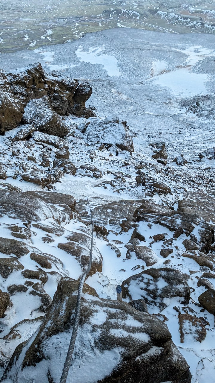
Higher up, the terrain changes. The slope steepens over tuff rock — brittle volcanic formations that fracture into steps and ledges. Two fixed ropes assist on short scrambles near the summit ridge. From here, the route levels into a wide plateau before one last push to the top.
At the summit, a viewing dial installed by the Icelandic Touring Association points to the surrounding peaks — Esja, Hengill, Skjaldbreiður, Móskarðshnúkar, and the lights of Reykjavík far below. On clear winter nights, the stars and occasional northern lights replace the sun.
Winter Conditions
Vífilfell can be climbed in any season, but winter changes the equation completely. Ice covers the tuff slabs and the scree turns treacherous.
Bring:
- Crampons or microspikes (but standard Esjubroddar may not be enough)
- Ice axe, and know self-arrest technique
- Windproof layers — gusts on the ridge can reach dangerous speeds
Our December ascent felt more like a mountaineering exercise than a hike. The steep descent on frozen scree demanded patience — and good balance.
Geology
Vífilfell formed during two subglacial eruptions in the Ice Age, when lava met trapped ice, creating tuff cones and layered ridges. The mountain sits within a network of fissures that mark Iceland’s slow continental drift. Its layered cliffs — dark basalt capped with paler ash — are textbook examples of volcanic sequence formation.
Practical Info
- Getting there: 30-minute drive from Reykjavík via Route 1 → turn right onto the gravel road at Sandskeið.
- Parking: Free, at the base of the quarry road.
- Facilities: None. Bring everything you need.
- Lighting: None — bring a strong headlamp if hiking at night.
- Safety: Avoid in storms; winds at the top can exceed 80 km/h.
Why Hike Vífilfell
Vífilfell is close yet remote, small yet serious. It’s where Reykjavík’s city lights fade and the highlands begin. Whether you climb it on a bright summer evening or under a December sky full of aurora, this modest peak reminds you that Iceland’s wilderness doesn’t start far from home — it starts right after the last streetlight.
Quick Facts
Trailhead: Vífilfell parking (64.05470520094077, -21.53130880130137)
Distance: 6.6 km
Elevation gain: 501 m
Difficulty: Challenging
Duration: 2–3 h
Region: Kópavogur / Capital area, Iceland

Leave a comment or a trail report