Few places on Earth condense Iceland’s drama like the south coast between Hella and Vík.
In less than 60 kilometers you pass three natural landmarks that define the island:
the elegant Seljalandsfoss, the thunderous Skógafoss, and the otherworldly Reynisfjara, Iceland’s black sand beach of legends.
It’s a loop of elements — water, stone, and sea — and one of the most rewarding day trips from Reykjavík.
Overview
| Stop | Type | Time on site | Coordinates |
|---|---|---|---|
| Seljalandsfoss | Waterfall | 30–45 min | 63.6156°N, 19.9928°W |
| Gljúfrabúi | Hidden waterfall | 15 min | 63.6202°N, 19.9895°W |
| Skógafoss | Waterfall | 45–60 min | 63.5321°N, 19.5110°W |
| Reynisfjara | Black sand beach | 40–60 min | 63.4044°N, 19.0451°W |
Drive from Reykjavík: ~2.5 h (180 km)
Total visit time: 5–6 h (with short walks and stops)
Best season: May–October (year-round possible)
Seljalandsfoss – Behind the Curtain
Seljalandsfoss tumbles 60 meters over a sheer cliff that once marked Iceland’s prehistoric coastline.
A narrow trail circles behind the waterfall, letting you stand inside the roar of the water — one of the few places in Iceland where you can do that.
Expect to get soaked. The ledge is slippery even in summer and iced over in winter. Bring waterproof layers and watch for tourists with umbrellas regretting their life choices.
Nearby: Walk 5 minutes north to Gljúfrabúi, hidden in a mossy cleft. You’ll wade through shallow water into a narrow chamber where sunlight filters down through mist — one of Iceland’s most cinematic corners.
Skógafoss – Power and Symmetry
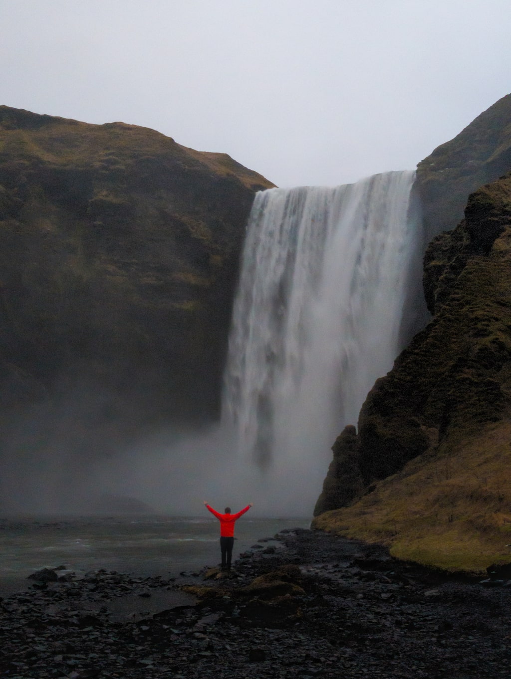
Thirty minutes east stands Skógafoss, a wall of water so perfectly proportioned it looks engineered.
The Skóga River plunges 60 m down a 25 m wide lip, producing constant mist and near-daily rainbows when sunlight breaks through.
A 370-step staircase climbs beside the falls to a panoramic deck — and the start of the Fimmvörðuháls trail, a highland route between glaciers Eyjafjallajökull and Mýrdalsjökull.
Stand below for scale: the roar drowns all sound, and every breath smells of glacier water.
It’s the kind of place where time slows down to the rhythm of falling water.
Reynisfjara – Iceland’s Black Sand Beach
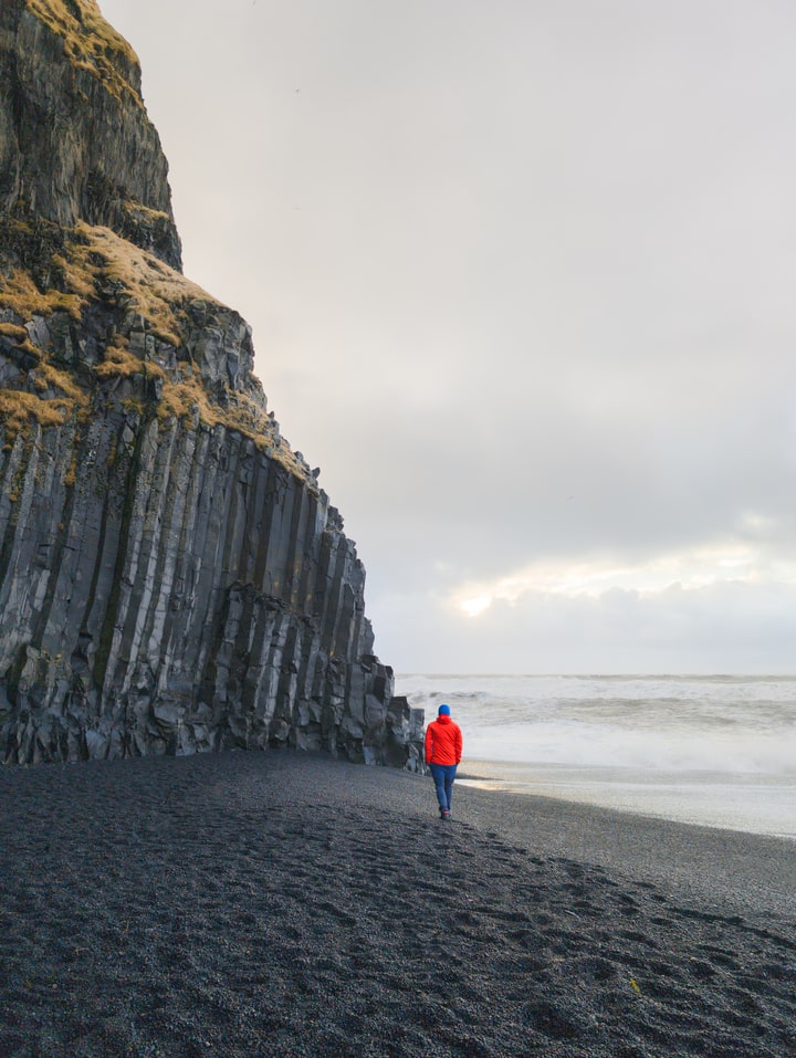
Finally, the road bends toward Vík í Mýrdal, where the Atlantic meets basalt.
Here lies Reynisfjara, the black sand beach famous for its hexagonal basalt columns, sea stacks, and the constant roar of surf against volcanic cliffs.
The sand isn’t sand at all — it’s pulverized lava, ground fine by centuries of waves.
Offshore rise the Reynisdrangar pillars, said in legend to be trolls turned to stone by daylight.
Safety note
Reynisfjara is powerful and unpredictable. Sneaker waves can surge 20–30 meters inland without warning. Stay well back from the waterline — every year, visitors underestimate its force.
Come at low tide for reflections on the wet basalt and the deep rumble of the waves echoing through the cave.
Facilities: Parking, café, toilets (ISK 1000).
Season: Year-round; stunning at sunrise or winter twilight.
Travel Tips
- Route: Reykjavík → Hvolsvöllur → Seljalandsfoss → Skógafoss → Reynisfjara → Vík (return same day or stay overnight).
- Driving time: 2h30 one way; roads paved all the way.
- Photography: Early morning light at Seljalandsfoss, mid-morning at Skógafoss, and sunset at Reynisfjara.
- Weather: All three can shift from calm to storm in minutes — windproof layers are mandatory.
- Nearby stops: Dyrhólaey lighthouse, Solheimasandur plane wreck, Vík Church viewpoint.
Why Visit
These three sites are Iceland distilled — glacier water, volcanic stone, and North Atlantic power colliding on a single stretch of coast.
Seljalandsfoss gives you intimacy, Skógafoss gives you scale, and Reynisfjara gives you awe.
Drive the route slowly. Step back often. And if the wind sprays salt and mist across your lens, leave it there — that’s Iceland signing its work.
Quick Facts
Seljalandsfoss:
- Height: 60 m
- Walk-behind trail
- Nearby Gljúfrabúi canyon waterfall
Skógafoss:
- Height: 60 m | Width: 25 m
- 370 steps to viewpoint
- Trailhead for Fimmvörðuháls
Reynisfjara:
- Black volcanic beach near Vík
- Basalt columns, sea stacks, and dangerous sneaker waves
- Formed from lava cooled by the ocean

Leave a comment or a trail report