Heimgarten to Herzogstand Hiking Adventure: Panoramic Peaks and Alpine Beauty”

· updated · 2 min read
Heimgarten Hiking view
Heimgarten to Herzogstand Hiking Adventure, Germany
Distance
14.4 km
Time
Full day
Ascent
+1,250 m
Descent
−1,172 m
High point
1,790 m
Difficulty
Moderate

The route

Heimgarten to Herzogstand Hiking Adventure, on the map

From my own GPX track. Move along the elevation profile or along the line on the map: both show the same point.

Distance14.4km
TimeFull day
Ascent+1,250m
Descent−1,172m
High point1,790m
DifficultyModerate

Walking time at your paceAn estimate without breaks, worked out from the distance and the climb.

  • Relaxed10 h 25 min
  • Average8 h 20 min
  • Fast6 h 40 min

Elevation

Elevation profile of Heimgarten to Herzogstand Hiking Adventure: Panoramic Peaks and Alpine Beauty”Starts at 808 m, climbs 1,250 m in total to a high point of 1,791 m after 6.4 km, and finishes at 825 m; 14.4 km in all.1,000 m1,500 m0 km2 km4 km6 km8 km10 km12 km14 kmWalchenseeHeimgarten · 1,791 m

How steep

  • 2.9 kmUnder 8%
  • 3.4 km8 to 15%
  • 5.7 km15 to 25%
  • 2.4 kmOver 25%

In two parts

Embed this map

Paste this into your page or post (in WordPress: a Custom HTML block). The map stays up to date with the guide, and the link under it leads your readers to the full guide.

What to pack15 things, for a summit, a long day, a swim

Every hike

For the summit

For a long day

Water and sun

The light for photographs

Today at Heimgarten: sunrise 06:57, sunset 16:59.

Today at Heimgarten: sunrise 06:57, sunset 16:59.

At Heimgarten, 1,791 m, in local time (Europe/Berlin), with an open horizon: the mountains around can hide the sun sooner.

In short

This full-day hike from Walchensee in Bavaria crosses Heimgarten and Herzogstand, reaching 1,790 m. The moderate route covers 14.4 km, with 1,250 m of ascent and 1,172 m of descent. It includes a ridge walk, and a cascading stream is mentioned on the descent.

Embark on a breathtaking alpine journey with a full-day hiking trip to the majestic peaks of Heimgarten (1790 m) and Herzogstand (1731 m). This moderately challenging mountain hike promises stunning panoramic vistas, a thrilling ridge walk, and a glimpse into the natural wonders of the Bavarian Alps.

Heimgarten Herzogstand hiking

How to get to Herzogstand

To get to Herzogstand, if you are traveling by car from Munich, you can leave the Garmisch autobahn at the Murnau/Kochel junction and continue on the B11 to Walchensee via Kochel. Once you arrive, you can park your car at the valley station of the Herzogstandbahn. Alternatively, you can take the train from Munich central station or Tutzing to Kochel am See. You can take bus line 9608 from the Kochel train station to the Walchensee Herzogstandbahn stop. You can check the timetable and book your tickets in advance.

About the Heimgarten and Herzogstand hike
Heimgarten to Herzogstand Hiking

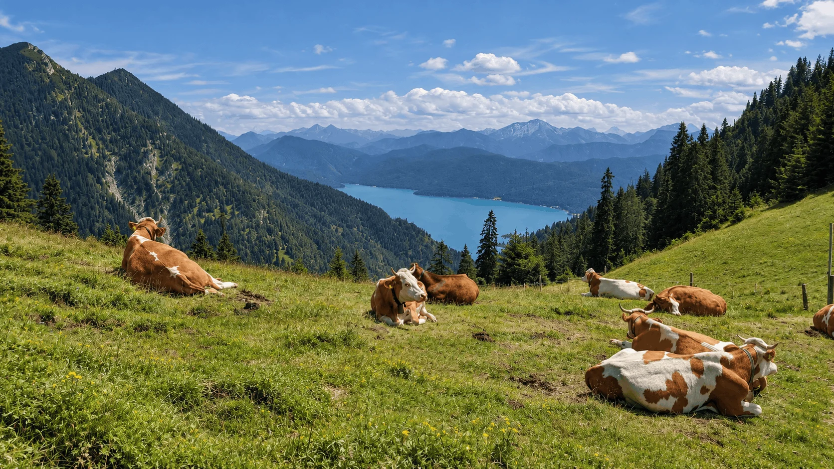
Begin your adventure by following the well-marked trail from Walchensee (800 m) to the summit of Heimgarten. The path gradually ascends, treating you to captivating glimpses of the shimmering Walchensee below. As you climb higher, the air gets crisper, and the beauty of the surrounding landscape unfolds.

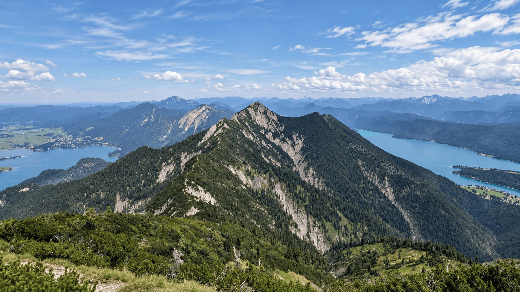
Upon reaching the summit of Heimgarten, you’ll be rewarded with a breathtaking panorama. The Herzogstand and its inviting Berggasthaus stand tall in the distance, beckoning you to continue your journey. Enjoy a refreshing break at the Heimgartenhütte, soaking in the sun-drenched terrace and replenishing your energy.

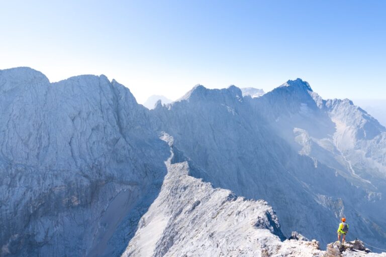
The ridge between Heimgarten and Herzogstand offers a thrilling yet safe experience. The sure-footedness required for certain sections adds a touch of excitement to the hike. The trail, adorned with secure handrails, leads you across this high-altitude path, granting unparalleled views of Murnauer Moos, Staffelsee, and beyond.

The descent from Herzogstand is just as enchanting as the ascent. The path winds through the mountain forest, offering glimpses of a cascading stream and providing a serene atmosphere for reflection. As you reach the valley station of the Herzogstandbahn, a sense of accomplishment fills your heart.

Heimgarten and Herzogstand stand as a testament to the natural beauty of Bavaria’s alpine treasures. This full-day hiking adventure offers a perfect blend of exhilarating trails, captivating vistas, and moments of serenity.

Points of interest: 
Starting point: Walchensee
Starting altitude: 810 m/alt
Highest altitude: 1’790 m/alt
Elevation gain: 1’250 m
Share this guide

Questions and comments

Ask me about this hike

Leave a comment or a trail report

Your email is never shown. A first comment appears once I have read it.

Trail report

Through my lens

More from Germany

All my photographs

Keep exploring

More from Bavarian Alps

All Germany guides
Granit Temaj

Get my new stories by email

Be the first to know when I come back from the mountains with a new route.

You will get one email to confirm. Unsubscribe any time. Privacy

Read the guide

Trail alerts

An email when someone reports how the path is, or when I update the guide. Nothing else, and one click stops it.

You confirm it by email first. Your address is used for these alerts only. Privacy

License this photograph

Tell me what it is for. I answer within a few days with a price and the licence.

Your name and email are used only to answer this request.

Newsletter

Get my new stories by email

Be the first to know when I come back from the mountains with a new route.

You will get one email to confirm. Unsubscribe any time. Privacy