Grebaje valley, Prokletije National Park, an outdoor paradise

· updated · 2 min read
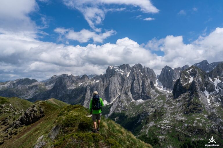
A hiker on a grassy ridge above Grebaje valley, with jagged Prokletije peaks beneath a cloudy blue sky
Grebaje valley, Montenegro
Distance
9.3 km
Ascent
+922 m
Descent
−901 m
High point
2,056 m
Water
No source along the hikecarry around 3 liters

The route

Grebaje valley, on the map

From my own GPX track. Move along the elevation profile or along the line on the map: both show the same point.

Distance9.3km
Ascent+922m
Descent−901m
High point2,056m

Walking time at your paceAn estimate without breaks, worked out from the distance and the climb.

  • Relaxed7 h 35 min
  • Average6 h
  • Fast4 h 50 min

Elevation

Elevation profile of Grebaje valley, Prokletije National Park, an outdoor paradiseStarts at 1,149 m, climbs 922 m in total to a high point of 2,035 m after 4.7 km, and finishes at 1,170 m; 9.3 km in all.1,500 m2,000 m0 km1 km2 km3 km4 km5 km6 km7 km8 km9 kmGrebajeTalijanka · 2,035 m

How steep

  • 0.5 kmUnder 8%
  • 2.4 km8 to 15%
  • 4.2 km15 to 25%
  • 2.2 kmOver 25%

In two parts

Embed this map

Paste this into your page or post (in WordPress: a Custom HTML block). The map stays up to date with the guide, and the link under it leads your readers to the full guide.

What to pack12 things, for a summit

Every hike

For the summit

The light for photographs

Today at Talijanka: sunrise 06:30, sunset 16:19.

Today at Talijanka: sunrise 06:30, sunset 16:19.

At Talijanka, 2,035 m, in local time (Europe/Podgorica), with an open horizon: the mountains around can hide the sun sooner.

In short

The 9.3 km hike starts in Grebaje Valley, Montenegro, and reaches Volušnica and Talijanka, with a high point of 2,056 m. It has 922 m of ascent and 901 m of descent. There is no water source along the route, so carry around 3 liters.

Grebaje Valley set in the heart of Prokletije (Accursed Mountains) is a hiking paradise located in southwest Montenegro. There you can find very beautiful mountains with gorgeous views like mount Volušnica and mount Taljanka (in the border between Albania and Montenegro) that have an amazing view of the Karanfili massif, or Karanfili peaks, Očnjak,  and Vezirova Brada pass.

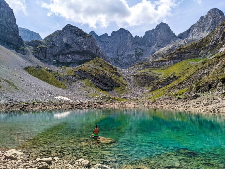
Green ridges and jagged peaks above Grebaje valley beneath a blue, cloud-filled sky

How to get to Grebaje Valley

Grebaje Valley is located around 155 km from the capital of Montenegro, Podgorica. You can drive there by car, or take the bus from Podgorica to Plav, and then take a taxi from Plav to Gusinje. From Gusinje you can walk for around 4 km to Grebaje.

Another way to go to Grebaje is hiking from Lepushe. This is one of the most beautiful hikes in Albania and Montenegro, where you will enjoy the views of the beautiful Karanfili massif.

About the Grebaje Valley

In Grebaje National Park you can find some restaurants and guesthouses that serve delicious local food. We had the chance to meet an Albanian family from Vusanje, that lives in a mountain hut during the summertime. They were very friendly and their food was 100% bio. We tried the blueberry pie, which was very delicious.

The trails in this park are very well signed. You need to pay a fee for entrance to this National Park. The prices are 1€/day/person and 3€ per tent.

Hike to mount Volušnica and mount Taljanka

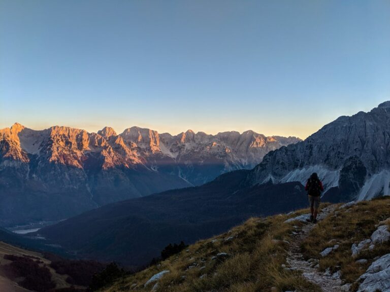
A hiker in a yellow shirt overlooks Grebaje Valley and jagged cliffs lit by low golden sunlight

The hike starts from Grebaje, and you will hike through a beautiful forest. After around 4 km, you will have the chance to reach mount Volušnica (1’897 m/alt)  where you can see the best views of this trail. Check out the picture:

Grebaje Talijanka

I think this is the best spot for camping.

After this, through the ridge, you may go to Talijanka peak, which has great views as well, and its elevation is 2’056 m/alt. There is no water source along this hike, so make sure to have around 3 liters of water. From Talijanka, you can go to Lepusha in Albania, or go back to Grebaje.

Check out the trail from Grebaje to Volušnica:
Share this guide

Questions and comments

2 comments

  1. Admir

    The name of the park is Prokletije (Accurded Mountains), and the area that is in the article is called Grebaje, so Grebaje ia not the park, its the part of the park

    Reply

    1. Granit Author

      Thank you so much Admir!

      Reply

Leave a comment or a trail report

Your email is never shown. A first comment appears once I have read it.

Trail report

Through my lens

From this walk

All my photographs

Keep exploring

More from Accursed Mountains

All Montenegro guides
Granit Temaj

Get my new stories by email

Be the first to know when I come back from the mountains with a new route.

You will get one email to confirm. Unsubscribe any time. Privacy

Read the guide

Trail alerts

An email when someone reports how the path is, or when I update the guide. Nothing else, and one click stops it.

You confirm it by email first. Your address is used for these alerts only. Privacy

License this photograph

Tell me what it is for. I answer within a few days with a price and the licence.

Your name and email are used only to answer this request.

Newsletter

Get my new stories by email

Be the first to know when I come back from the mountains with a new route.

You will get one email to confirm. Unsubscribe any time. Privacy