As winter blankets the picturesque landscapes of Incline Village with a pristine layer of snow, adventure enthusiasts and nature lovers are presented with a unique opportunity to embark on a thrilling journey to Rifle Peak. This challenging yet immensely rewarding winter hike, spanning 12 kilometers with an elevation gain of 820 meters, leads to the majestic summit of Rifle Peak at 2,892 meters. Join us as we explore the enchanting snowy vistas and climb this remarkable peak in all its winter glory.

How to Get There
Before we delve into the details of the Rifle Peak hike, let’s first discuss how to reach the starting point in Incline Village. Incline Village is nestled along the shores of Lake Tahoe, making it a convenient gateway for outdoor adventures in the Sierra Nevada Mountains.
If you’re coming from out of town, plan your trip there. You can reach Lake Tahoe by car from various nearby cities, including Reno, Nevada, and Sacramento, California. From Lake Tahoe, drive to Incline Village, located on the northeastern side of the lake. Incline Village is a charming resort community known for its stunning natural surroundings and outdoor recreational opportunities.
Once you’ve arrived in Incline Village, you’re all set to embark on your winter adventure to Rifle Peak.
About the Rifle Peak Hike

The hike to Rifle Peak is a thrilling winter adventure that will test your hiking skills and reward you with breathtaking views of the snow-covered landscape. Here’s a detailed description of the trail:
Trailhead: Begin your journey at Marlene Street Incline, where you can conveniently park your vehicle in the available street parking.
Trail Characteristics: The trail to Rifle Peak is known for its steep and challenging terrain, making it a perfect choice for experienced hikers seeking a winter challenge.
Trail Route: The hike initially follows a road until you reach a water tower, from where the trail transitions into a natural surface trail. The path gradually ascends along the ridgeline, offering intermittent glimpses of the mesmerizing winter scenery.
We started our hike from Incline Village, which adds approximately 200 meters of elevation gain and an extra 5 kilometers of walking distance to your journey. Be prepared for this additional challenge, as it contributes to the overall difficulty of the hike.
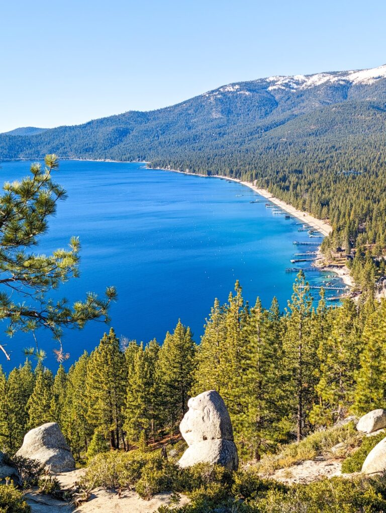
As you make your way up Rifle Peak, the snow-covered pines, frozen alpine lakes, and panoramic vistas will leave you in awe. The sense of accomplishment upon reaching the summit and gazing out over the winter wonderland below is an experience like no other.
In conclusion, hiking to Rifle Peak in the snow from Incline Village is a thrilling winter adventure that promises physical challenge and natural beauty. With the right preparation and gear, you can climb this snowy peak and witness the magic of Incline Village transformed into a winter wonderland. So, bundle up, lace up your boots, and get ready to embrace the chill on your journey to Rifle Peak.
Points of interest:
Starting point: Incline Village
Total distance: 12 km
Elevation gain: 820 m
Highest peak: Rifle Peak (2,892 m)


Leave a comment or a trail report