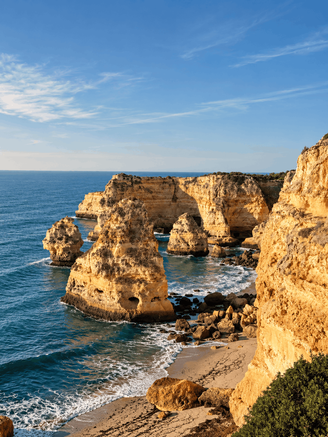
The Seven Hanging Valleys Trail is an easy, one-way coastal hike in the Algarve, Portugal, from Praia da Marinha to Praia do Vale de Centeanes near Carvoeiro. It covers 6.3 km with 197 m ascent and 223 m descent, taking around 2 h 30 min.
Known locally as Percurso dos Sete Vales Suspensos, it is the Algarve’s most popular coastal hike, passing Benagil and some of the coast’s most beautiful beaches. We hiked it in October 2026 with our child in a carrier backpack and had no problems.
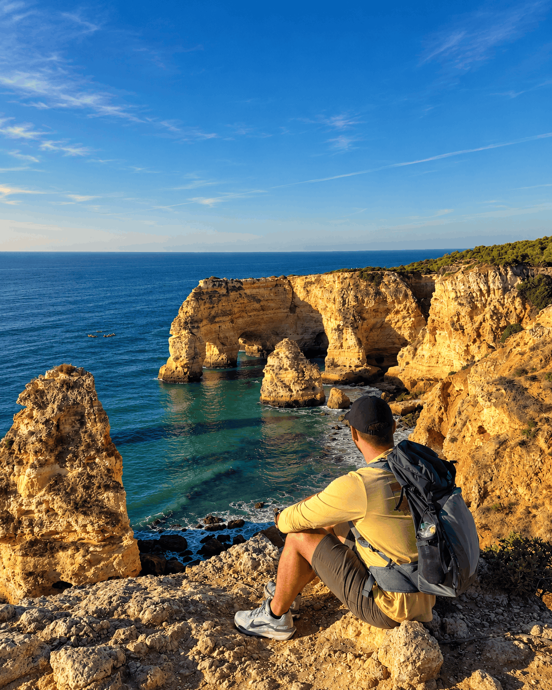
Points of interest
| Starting point | Praia da Marinha, Lagoa |
| End point | Praia do Vale de Centeanes, Carvoeiro |
| Distance | 6.26 km one way |
| Elevation gain / loss | 197 m / 223 m |
| Highest / lowest point | 49 m / 10 m |
| Moving time | 2 h 27 min |
| Difficulty | Easy |
| Trail type | One way, Uber back to the car (around 6 EUR) |
| Parking | Free, close to Praia da Marinha, gets full early |
| Food and drinks | Café close to Praia de Benagil |
| With kids | Yes, we did it with a child in a carrier backpack |
The one-way route measures 6.3 km, with 197 m ascent, 223 m descent and a highest point of 48 m. Allow 2 h 30 min for walking; our recorded moving time was 2 h 27 min, before allowing for stops.
How to get to Praia da Marinha
The trail starts at Praia da Marinha, in the municipality of Lagoa. Follow Google Maps to the beach; the access road is paved. We parked close to Marinha, and parking was free.
I would suggest arriving early because the parking gets full. If you are coming by public transport, bus 77 serves the Praia da Marinha, Benagil and Lagoa route.
We walked one way to Praia do Vale de Centeanes, then took an Uber back to the car for around 6 EUR. This saved us walking the same trail back. If you prefer a longer day, the return hike is around 12.5 km.
About the Seven Hanging Valleys Trail
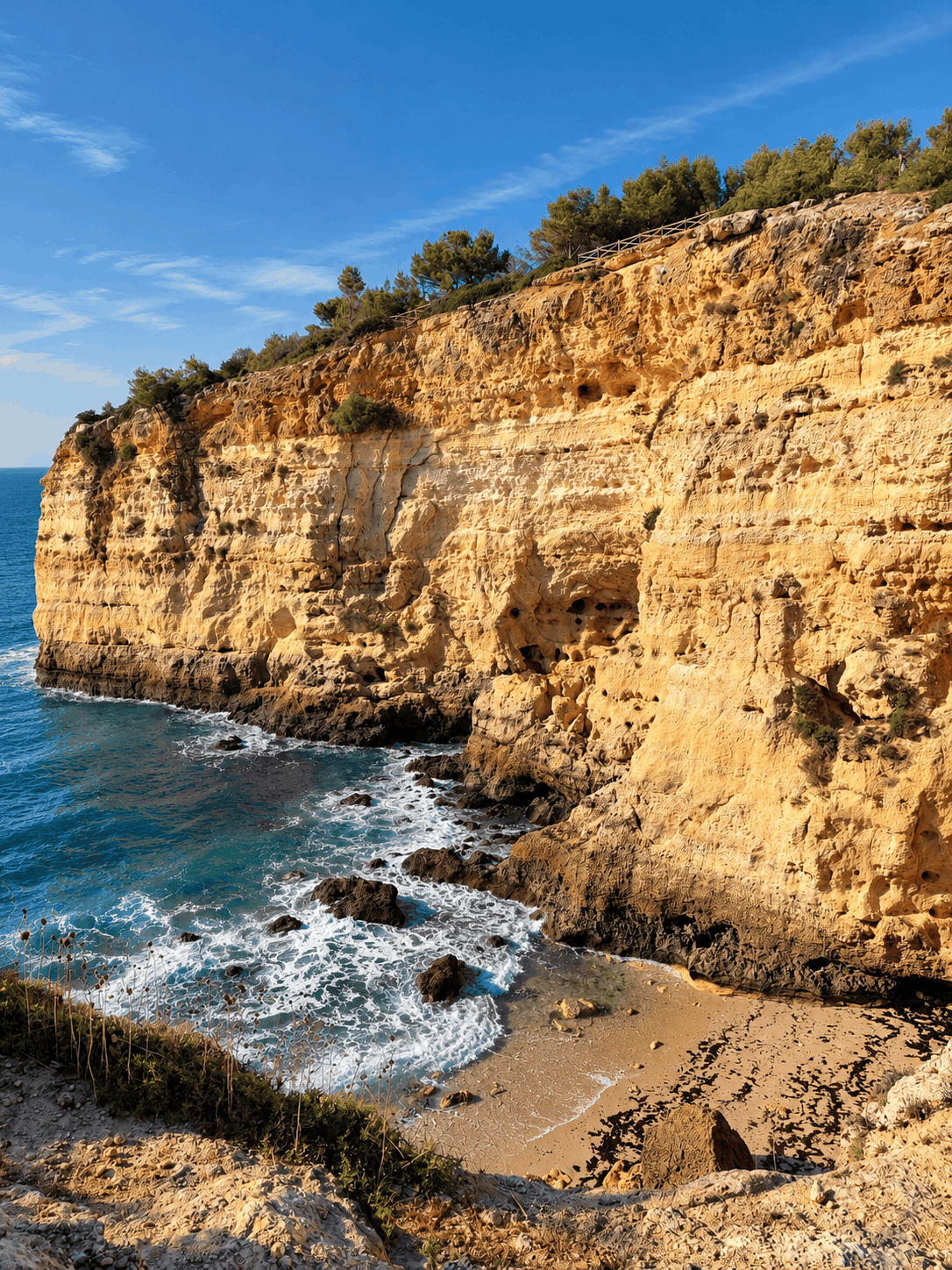
The trail follows the cliffs west, going down and up through the valleys between the beaches. Although its highest point is only 48 m, those climbs add up to 197 m of ascent. It is very well marked, so we found it hard to get lost.
These are the main points along the route, measured from the Marinha parking:
- Algar: 0.7 km
- Praia do Cão Raivoso: 1.0 km
- Praia da Corredoura: 1.3 km
- Benagil cave, seen from above: 1.6 km
- Praia de Benagil: 2.2 km
- Praia do Carvalho: 2.8 km
- Leixão do Ladrão: 3.7 km
- Praia do Vale Espinhaço: 4.2 km
- Farol de Alfanzina, the lighthouse: 4.5 km
- Algar: 4.8 km
- Praia do Vale de Centeanes: 6.3 km
Praia da Marinha
The hike starts above Praia da Marinha, one of the most famous beaches in the Algarve. From the first meters, you walk on top of the cliffs as the trail follows the coast west.

Benagil cave and Praia de Benagil
After 1.6 km, you pass above Benagil cave, also called Algar de Benagil. You cannot enter the cave from the trail. It can only be reached from the sea.
We planned to take a boat tour into the cave but skipped it because of the weather conditions that day. Since August 2024, swimming into the cave, landing on the beach inside it and renting a kayak without a guide are not allowed. To go inside, you need to book a licensed boat, kayak or SUP tour.
Praia de Benagil is 2.2 km from the start. We stopped at a café nearby for a drink. This was our only stop for food and drinks.
Praia do Carvalho
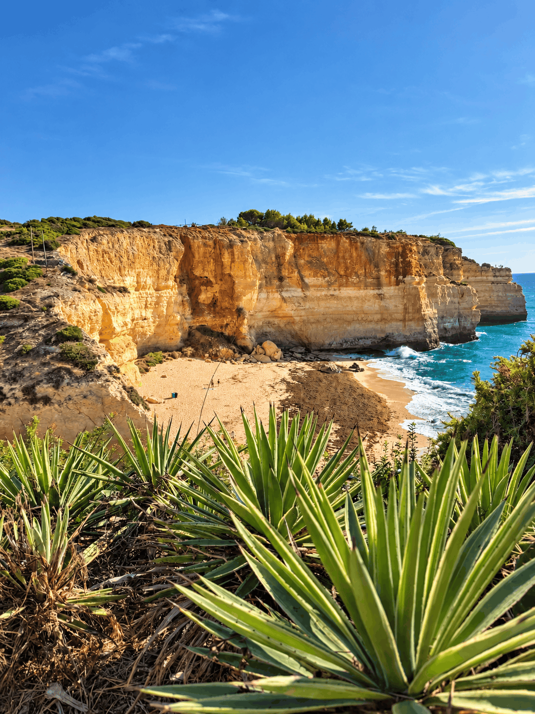
For me, Praia do Carvalho is the best spot on the whole trail, 2.8 km from the start. We didn’t swim, but if you plan to swim during the hike, this is the beach I would choose. You reach the beach through a tunnel in the rock.
Praia do Vale Espinhaço to Vale de Centeanes
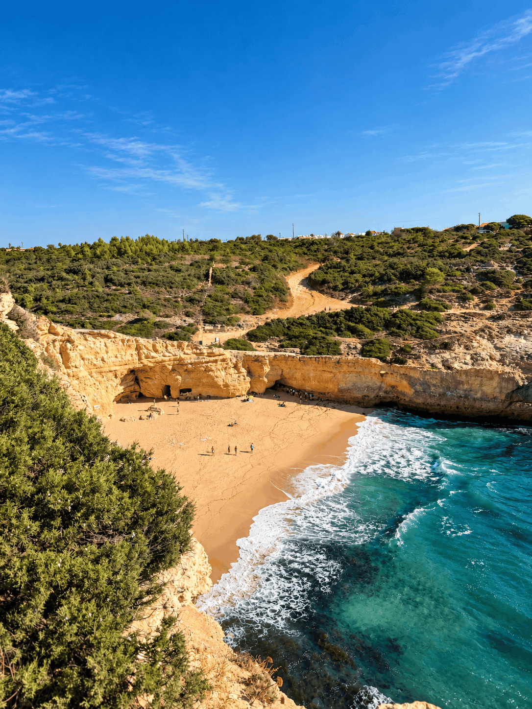
After Leixão do Ladrão, the trail passes Praia do Vale Espinhaço at 4.2 km and the Alfanzina lighthouse at 4.5 km. It ends at Praia do Vale de Centeanes, close to Carvoeiro, where we took our Uber back to Marinha.
Water and food on the trail
There are some small cafés and restaurants along the trail, but no other water sources. Take around 1 liter of water. I would suggest carrying more in summer, when it can get hot on the cliffs.
Best time to hike the Seven Hanging Valleys Trail
The trail can be hiked all year. We walked it in October and had a sunny day, although the weather conditions led us to skip our planned cave tour. I would suggest starting early to avoid the heat on the cliffs and find parking near Marinha.
Difficulty and hiking with a child
This is an easy hike, but the cliffs are very high. There are stairs and uneven sections where the path goes down and up the valleys. Keep that in mind when planning with kids.
We hiked the whole route with our child in a carrier backpack and had no problems. The clear trail markings also made navigation straightforward.
More walks and hikes in Portugal
Frequently asked questions
How long is the Seven Hanging Valleys Trail?
It is 6.3 km one way from Praia da Marinha to Praia do Vale de Centeanes, with 197 m ascent and 223 m descent. Walking back makes it around 12.5 km.
How long does the Seven Hanging Valleys Trail take?
Allow 2 h 30 min for the one-way walk. Our moving time was 2 h 27 min, with extra time needed for photos, beaches and our café stop.
Is the Seven Hanging Valleys Trail difficult or suitable for kids?
It is an easy hike, but there are stairs, uneven sections and high cliffs. We walked the whole route with our child in a carrier backpack and had no problems.
Where do you park, and how do you get back after the hike?
We parked free near Praia da Marinha, where spaces fill up later in the day. After finishing at Praia do Vale de Centeanes, we took an Uber back for around 6 EUR.
Is there drinking water along the Seven Hanging Valleys Trail?
There are small cafés and restaurants along the route, but no other water sources. Take around 1 liter of water, and I would suggest carrying more in summer.
Can you enter Benagil cave from the trail?
No, the trail passes above the cave at 1.6 km, but entry is only from the sea with a licensed boat, kayak or SUP tour. Since August 2024, swimming into the cave, landing on its beach and renting a kayak without a guide are not allowed.



Leave a comment or a trail report