For the trail · alpventurer.com/vusanje-to-valbona
Vusanje to Valbona via Rosi Pass
Vusanje to Valbona via Rosi Pass · Albania
- Time
- ~9 h
- Difficulty
- Difficult
- Season
- June–November
- Water
- About 2 litres; the Blue Eye of Vusanje is the last water source and may be dry in October and November
- Parking
- Free
In short
This difficult 18.3 km hike crosses from Vusanje, Montenegro, to Valbona, Albania, via Rosi Pass. It takes about 9 hours, with 1,200 m of ascent and a high point of 2,040 m. The route is available from June to November; carry about 2 litres of water, as the Blue Eye of Vusanje may be dry in October and November.
The route
- Distance
- 18.3 km
- Ascent
- +1,200 m
- Descent
- −1,250 m
- High point
- 2,040 m
- Lowest point
- 864 m
A Vusanje: 42.52142, 19.84187B Valbona: 42.45049, 19.88834▲ Qafa e Rosit, Piramida 38: 42.47395, 19.83832
Walking time, without breaks
- Relaxed11 h
- Average8 h 45 min
- Fast7 h
How steep
- Under 8% 6.2 km
- 8 to 15% 4.2 km
- 15 to 25% 3.9 km
- Over 25% 2.8 km
In two parts
- Up to Qafa e Rosit, Piramida 38 10.0 km · +1,162 m
- Down to Valbona 7.1 km · −1,084 m
What to pack
Every hike
- Water: about 3.5 litres (half a litre an hour)
- Rain jacket
- A warm layer (fleece or light down)
- Sun cap, sunglasses and sun cream
- Boots or trail shoes with good grip
- Phone with the map offline, and a power bank
- Small first aid kit
- Headlamp, in case it gets late
- Some cash and your ID
For the summit
- Hat and gloves: it is colder and windier at the top
- Walking poles, for the way down
For a long day
- Lunch, and a snack for every two hours
- Salty snacks or electrolytes
- Blister plasters
The guide
Vusanje to Valbona is one of the best trails of the Accursed Mountains. Regardless of the fact that it is not very popular (like Valbona to Theth), I think it is very beautiful too. This hike is not only a pass from a village to another village, but it is also a pass-through two beautiful Valleys, Vusanje Valley to Valbona Valley, and it is a pass from the country of Montenegro to Albania. So, you have the chance to cross the border with a view!
How to get to Vusanje
The starting point for this trail is near Gërla Canyon in Vusanje, Montenegro. You need to drive around 4 hours from the capital of Kosovo, Prishtina (around 215 km), or 3 hours from the capital of Montenegro, Podgorica (around 150 km).
Also, you can take the bus to Plav or Gusinje and then take a taxi from there to Vusanje.
If you have a 4 wheel car, you can drive up to Zastan hut, which may save you around 2 hours.
About the Vusanje to Valbona hike
Vusanje to Valbona hike starting point is near Gërla Canyon. There you can find a restaurant called Restaurant Hartini. Near the restaurant, you can find the Gërla waterfall.
After 1.5 km of walk, on your right side, you can find a very beautiful spring called, Blue Eye of Vusanje or Oko Skakavice (The eye of a grasshopper). The water is drinkable and there you can find the last water source of this trail. (Note: During October and November is completely dry, so you need to fill the bottles to the Restaurant I mentioned above):
You will walk through an unpaved road for around 5.8 km, up to Zastan hut.
From there you will take the trail, ascending for around 5 km up to the border between Montenegro and Albania.
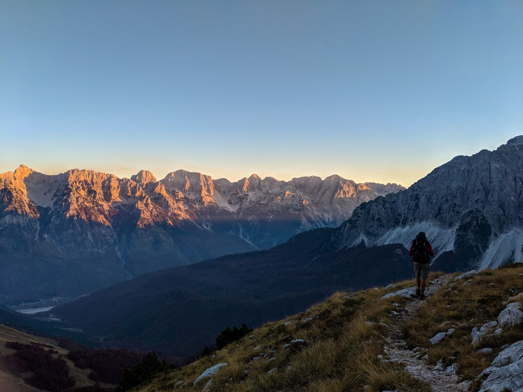
After this, you will go downhill through the very beautiful scenery of the Valbona Valley:
After around 30 mins of walking, you will see a very beautiful old mountain hut. The owner is very friendly, and there you can have the chance to drink a beer or something. He carries all the drinks from Valbona with a mule.
After you pass the hut, you will descent to Kukaj village, and then to the Valbona Valley. The total distance for this trail is 18.3 km, and you need around 2 liters of water.
Note:
- You need to obtain cross-border permission to take this trail.
- This trail is available starting from June until November. The trail is dangerous during the snow season.
Points of interest:
Starting point: Vusanje
Starting altitude: 860 m/alt
Highest altitude: 2’040 m/alt
Elevation gain: 1’200 m