For the trail · alpventurer.com/theth-and-nderlysa
Theth and Nderlysa, the isolated villages of Albania
Theth and Nderlysa · Albania
- Parking
- Free
In short
Theth and Nderlysa are villages in Albania’s Accursed Mountains, with guesthouses and sights including Grunas Waterfall and Blue Eye spring. From Theth Center, Nderlysa is 8 km away along an unpaved road. You can hike there or take a taxi.
What to pack
Every hike
- Water: half a litre for every hour of walking
- Food and snacks for the day
- Rain jacket
- A warm layer (fleece or light down)
- Sun cap, sunglasses and sun cream
- Boots or trail shoes with good grip
- Phone with the map offline, and a power bank
- Small first aid kit
- Headlamp, in case it gets late
- Some cash and your ID
Nights on the way
- Sleeping bag liner (a sleeping bag where the hut has none)
- Dry clothes for the evening
- Toothbrush, small towel and earplugs
- Cash for huts and guesthouses
- Your bookings
The guide
Theth and Nderlysa, are the most beautiful and isolated villages of the Accursed mountains (Prokletije), therefore the last years they have become famous destinations for outdoor enthusiasts from all around the world.
How to get to Theth and Nderlysa
There are two ways to go to Theth and Nderlysa:
From Shkodra
During the summer you have minibuses which travel every morning (around 7 a.m) from Rus in Shkodra.
The minibus goes from Shkodra to Koplik where you can find a supermarket. 70% of the road is unpaved and it takes 3-4 hours to arrive in the Theth village, along the road the views are great.
From Valbona
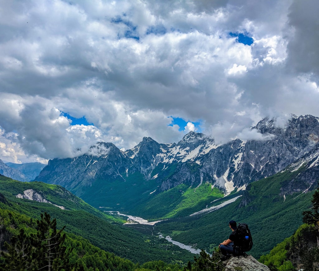
If you want to hike in one of the most beautiful paths in Albania, probably you need to hike from Valbona to Theth.
Check this trail: Valbona to Theth
Where to eat and sleep
There are a lot of Guesthouses in Theth. Cheap, traditional, cozy and they serve you very delicious food. During the summer, the Guesthouses are usually full of tourists, therefore make sure to book them early.
I think now you have a mini market too, which is located in Theth Center.
Top places
Kulla e ngujimit (Lock-in Tower) and Church of Theth are two most visited destinations. Kulla e ngujimit is a historical destination, very important for the locals and shows how mountain men were trying to avoid the blood feud.
A great outdoor destination is definitely Grunas waterfall, check out the picture:
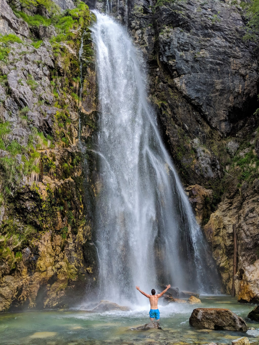
Follow the trail from Theth Center to Grunas waterfall:
Theth - Grunas Waterfall - Theth
- Distance
- 6.2 km
- Ascent
- +177 m
- Descent
- −190 m
- High point
- 801 m
- Lowest point
- 704 m
A Start: 42.39716, 19.77244▲ High point: 42.37741, 19.79508
Walking time, without breaks
- Relaxed2 h 30 min
- Average2 h
- Fast1 h 40 min
How steep
- Under 8% 4.8 km
- 8 to 15% 0.9 km
- 15 to 25% 0.2 km
- Over 25% 0.3 km
Another destination is Nderlysa village, where you can find the canyon with so many beautiful natural pools, and Blue eye spring as well.
You can hike for a day, or pay for a taxi from Theth center, the total distance from Theth center to Nderlysa is 8 km, through an unpaved road.
In Nderlysa you can find great Guesthouses too. In my opinion, the Guesthouse called “Bjeshka” is the best one there.
You can go from Theth to Grunas waterfall and then through a sheep path to Nderlysa:
Check out the trail from Theth Center – Grunas Waterfall – Nderlysa:
Theth - Grunas Waterfall - Nderlysa
- Distance
- 7.0 km
- Ascent
- +134 m
- Descent
- −402 m
- High point
- 817 m
- Lowest point
- 522 m
A Start: 42.39676, 19.77289B Finish: 42.35587, 19.77443▲ High point: 42.37748, 19.79481
Walking time, without breaks
- Relaxed3 h
- Average2 h 20 min
- Fast1 h 55 min
How steep
- Under 8% 4.9 km
- 8 to 15% 0.9 km
- 15 to 25% 0.8 km
- Over 25% 0.4 km
In two parts
- Up to the high point 3.2 km · +131 m
- Down to the finish 3.8 km · −300 m
Trail from Nderlysa to Blue Eye:
Nderlysaj - Vaskat - Blue Eye
- Distance
- 6.1 km
- Ascent
- +391 m
- Descent
- −300 m
- High point
- 689 m
- Lowest point
- 524 m
A Start: 42.35569, 19.77351▲ High point: 42.36273, 19.75152
Walking time, without breaks
- Relaxed3 h 20 min
- Average2 h 40 min
- Fast2 h 10 min
How steep
- Under 8% 3.6 km
- 8 to 15% 1.7 km
- 15 to 25% 0.5 km
- Over 25% 0.3 km
In two parts
- Up to the high point 3.7 km · +273 m
- Back down to the start 2.4 km · −181 m