For the trail · alpventurer.com/roques-de-garcia
Roques de García Circular Trail, Teide National Park
Roques de García Circular Trail · Spain
In short
Roques de García circular trail in Teide National Park, Tenerife: 4.3 km, 217 m gain, 1 h 46 min, parking, best time and tips.
The route
- Distance
- 4.2 km
- Ascent
- +203 m
- Descent
- −181 m
- High point
- 2,204 m
- Lowest point
- 2,039 m
A Start: 28.22374, -16.62895▲ High point: 28.23178, -16.64042
Walking time, without breaks
- Relaxed1 h 55 min
- Average1 h 35 min
- Fast1 h 15 min
How steep
- Under 8% 2.6 km
- 8 to 15% 0.6 km
- 15 to 25% 0.9 km
- Over 25% 0.2 km
What to pack
Every hike
- Water: about 1 litres (half a litre an hour)
- Food and snacks for the day
- Rain jacket
- A warm layer (fleece or light down)
- Sun cap, sunglasses and sun cream
- Boots or trail shoes with good grip
- Phone with the map offline, and a power bank
- Small first aid kit
- Headlamp, in case it gets late
- Some cash and your ID
For the summit
- Hat and gloves: it is colder and windier at the top
- Walking poles, for the way down
The guide
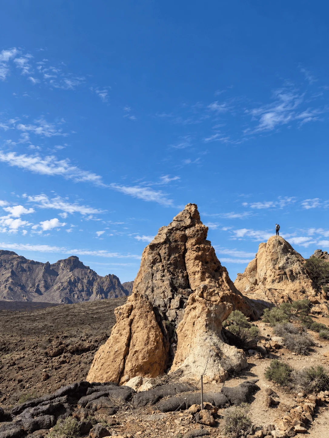
The Roques de García circular trail is a 4.3 km loop with 217 m of elevation gain in Teide National Park, Tenerife. It is one of the most popular hikes on the island, and it takes you around the Roques de García rock formations, with views of Mount Teide almost the whole way.
We hiked it in March 2026 and it took us 1 hour and 46 minutes. The trail is short and easy, but it has some rocky sections and a steep climb towards the end. It is very, very popular, so I would suggest going in the morning.
Points of interest
| Starting point | Near Ermita de Las Nieves, by the Parador de Las Cañadas del Teide |
| Distance | 4.3 km |
| Elevation gain / loss | 217 m / 217 m |
| Highest / lowest point | 2,213 m / 2,039 m |
| Moving time | 1 h 46 min |
| Difficulty | Easy, with rocky sections and a steep climb near the end |
| Trail type | Loop |
| Trail number | Sendero 3 (PNT-03) |
| Best time of day | Morning, before the crowds |
How to get to the Roques de García
The trail starts near Ermita de Las Nieves, next to the Parador de Las Cañadas del Teide, in the middle of Teide National Park. You reach it by car on the TF-21 road, which crosses the park. There are parking spaces by the Parador and at Mirador de la Ruleta, but this is one of the busiest spots in the park, so arrive early.
Buses also stop at the Parador, but there are only a few per day, so check the current TITSA timetable before you go.
About the Roques de García hike
The whole loop stays above 2,000 m, between 2,039 m and 2,213 m, so the elevation changes are small. The main points along the way are:
- Mirador de la Ruleta
- Mirador Roques de García
- Roques de García rock formations
- Roque Félix Méndez
Roques de García
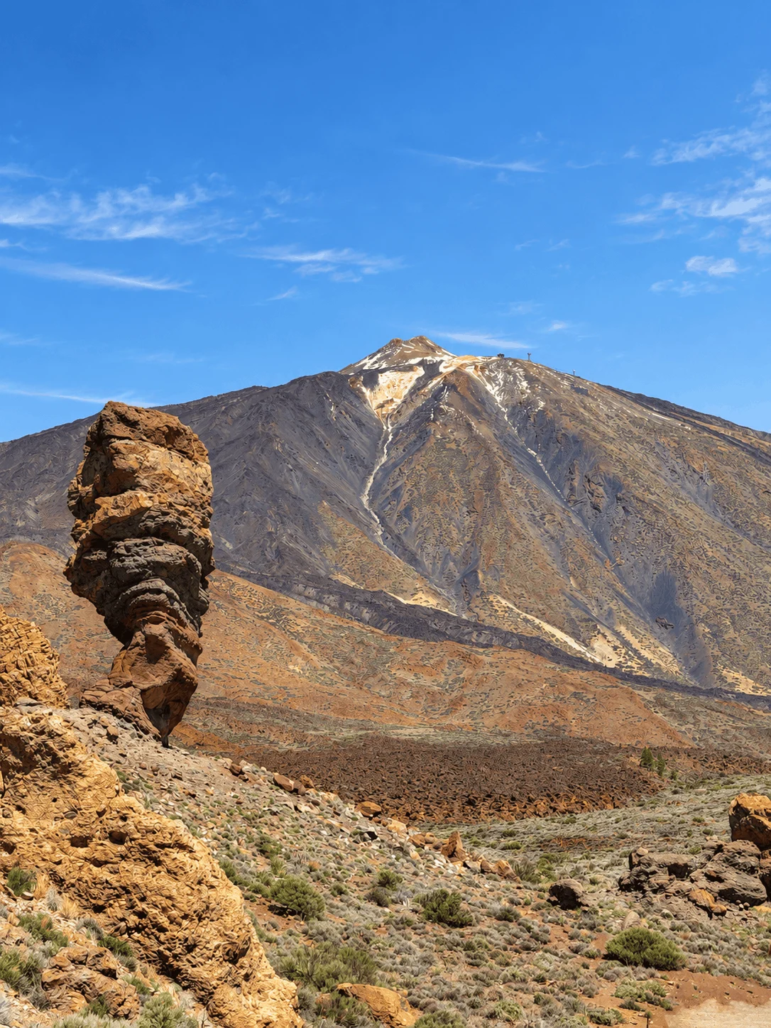
The Roques de García are the most famous rock formations in Teide National Park, and the trail goes all the way around them. The best known is Roque Cinchado, the rock that used to be printed on the old 1,000 peseta notes.
Views of Mount Teide
Along the trail, you have incredible views of Mount Teide and the volcanic landscape around it. The volcanic formations make it feel almost like another planet.
Trail conditions
Most of the trail is easy to walk, but some sections are rocky, and there is a steep climb towards the end of the loop. There are no water refill points on the trail, so bring water with you.
Best time to hike
This is one of the most visited places in Tenerife, and the trail gets very crowded later in the day. I would suggest going in the morning, when there are still parking spaces and the trail is quieter.
Frequently asked questions
How long is the Roques de García trail?
The circular trail is 4.3 km long, with 217 m of elevation gain and loss.
How long does the Roques de García hike take?
Our moving time was 1 hour and 46 minutes. Add extra time for photos at the viewpoints.
Is the Roques de García trail difficult?
No, it is an easy hike. There are some rocky sections and one steep climb near the end.
Where does the Roques de García trail start?
Near Ermita de Las Nieves, next to the Parador de Las Cañadas del Teide, on the TF-21 road in Teide National Park.
Do you need a permit for the Roques de García trail?
No. The trail is free, and you don’t need a permit or a reservation. The permit is only required for the summit of Mount Teide.
When is the best time to hike the Roques de García?
In the morning. The trail is very popular, and both the parking and the trail get crowded later in the day.