For the trail · alpventurer.com/french-alps-four-day-adventure
Hiking in the French Alps: A Four-Day Adventure
Hiking in the French Alps · France
In short
This four-day hiking itinerary in the French Alps includes Dent du Villard from Courchevel 1650, Le Petit Mont Blanc from Pralognan-la-Vanoise, Cascade des Poux and Aiguille de la Grande Sassière. It combines summit hikes with an easier walk to a waterfall.
What to pack
Every hike
- Water: half a litre for every hour of walking
- Food and snacks for the day
- Rain jacket
- A warm layer (fleece or light down)
- Sun cap, sunglasses and sun cream
- Boots or trail shoes with good grip
- Phone with the map offline, and a power bank
- Small first aid kit
- Headlamp, in case it gets late
- Some cash and your ID
Nights on the way
- Sleeping bag liner (a sleeping bag where the hut has none)
- Dry clothes for the evening
- Toothbrush, small towel and earplugs
- Cash for huts and guesthouses
- Your bookings
The guide
The French Alps are a hiker’s paradise, with their stunning mountain ranges, pristine lakes, and picturesque villages. I planned a hiking trip to the French Alps, and here’s the four-day itinerary that I took; it will take you to some of the most beautiful and challenging trails in the region.
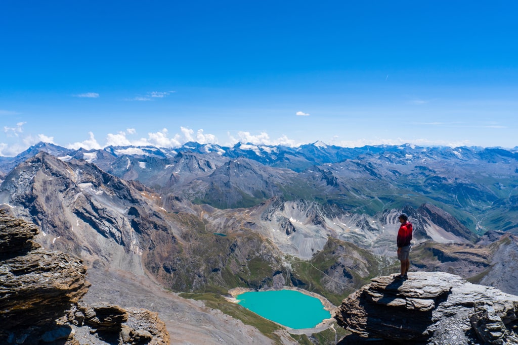
Day 1: Dent du Villard peak (2285m) from Courchevel 1650
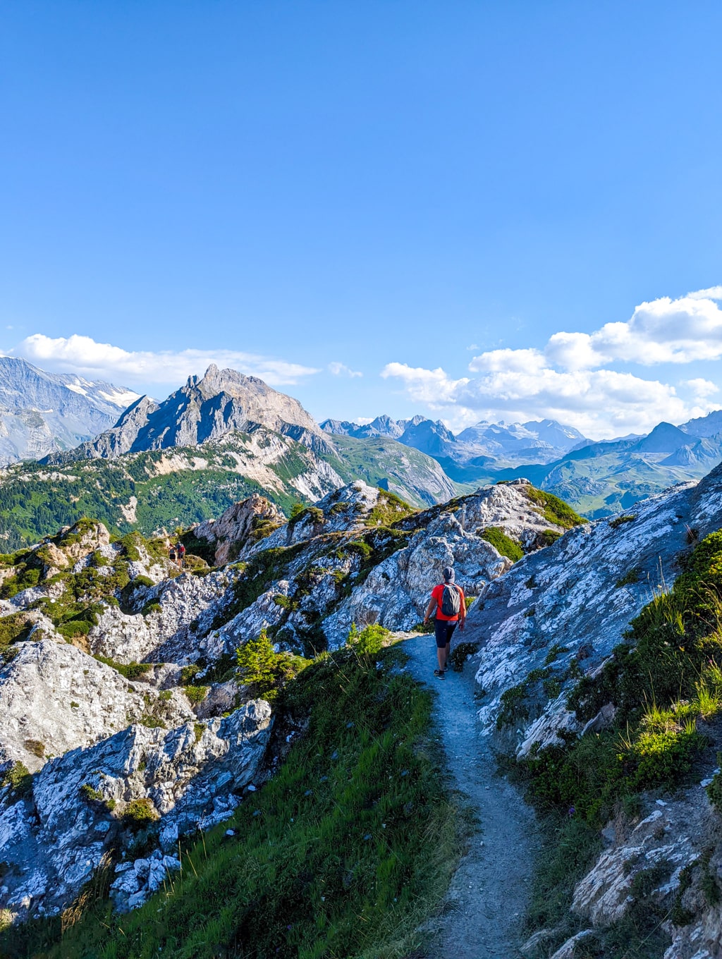
The first day of my hiking adventure in the French Alps starts with a challenging but rewarding trail that takes me to the summit of Dent du Villard. The trail starts in Courchevel 1650 and covers a distance of 10.05 km with an elevation gain of 830 m. The trail is steep in some sections and requires a good level of fitness, but the views from the summit are worth the effort. From the top, I could see the beautiful mountain ranges of the Tarentaise valley and the surrounding villages. After reaching the summit, I returned to Courchevel 1650 for a well-deserved rest.
Courchevel 1650 - Dent du Villard (2285m) - Courchevel 1650
- Distance
- 9.5 km
- Ascent
- +690 m
- Descent
- −715 m
- High point
- 2,232 m
- Lowest point
- 1,532 m
A Start: 45.40776, 6.66839▲ High point: 45.41890, 6.67672
Walking time, without breaks
- Relaxed6 h 10 min
- Average4 h 55 min
- Fast3 h 55 min
How steep
- Under 8% 1.7 km
- 8 to 15% 3.1 km
- 15 to 25% 3.5 km
- Over 25% 1.2 km
In two parts
- Up to the high point 5.2 km · +691 m
- Back down to the start 4.2 km · −700 m
Day 2: Pralognan-la-Vanoise – Le Petit Mont Blanc (2680m) – Pralognan-la-Vanoise
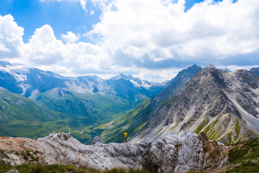
The second day of my hike takes me to Le Petit Mont Blanc, located in the heart of the Vanoise National Park. The trail starts in Pralognan-la-Vanoise and covers a distance of 9 km with an elevation gain of 750 m. The trail is relatively easy and offers beautiful views of the mountains and the glaciers. I spotted some local wildlife, including chamois and ibex, along the way. The summit of Le Petit Mont Blanc offers panoramic views of the surrounding peaks, including the Grand Mont Blanc. After reaching the summit, I returned to Pralognan-la-Vanoise for the night.
Pralognan-la-Vanoise - Le Petit Mont Blanc (2680m) - Pralognan-la-Vanoise
- Distance
- 9.4 km
- Ascent
- +721 m
- Descent
- −829 m
- High point
- 2,630 m
- Lowest point
- 1,801 m
A Start: 45.33313, 6.68864B Finish: 45.33863, 6.69499▲ High point: 45.35608, 6.68655
Walking time, without breaks
- Relaxed6 h 35 min
- Average5 h 15 min
- Fast4 h 10 min
How steep
- Under 8% 1.8 km
- 8 to 15% 2.1 km
- 15 to 25% 4.6 km
- Over 25% 0.9 km
In two parts
- Up to the high point 4.1 km · +721 m
- Down to the finish 5.3 km · −829 m
Day 3: Courchevel 1650 – Cascade des Poux
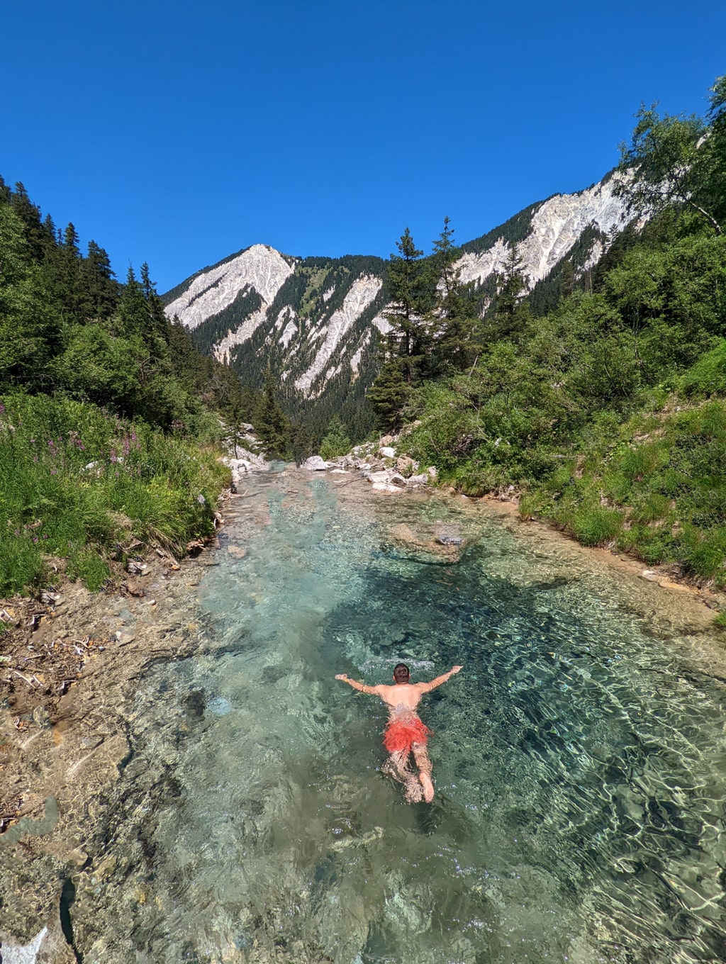
On the third day of my hike, I took a break from the summit climbs and enjoyed a more leisurely hike to the Cascade des Poux. The trail starts in Courchevel 1650 and covers a distance of 5 km with an elevation gain of 240 m. The trail is well-maintained and offers beautiful views of the mountains and the cascading waterfall at the trail’s end. The hike takes about 2-3 hours to complete and is a great way to enjoy the great outdoors.
Courchevel 1650 - Cascade des Poux - Courchevel 1650
- Distance
- 4.8 km
- Ascent
- +227 m
- Descent
- −234 m
- High point
- 1,771 m
- Lowest point
- 1,547 m
A Start: 45.40788, 6.66829▲ High point: 45.39521, 6.67497
Walking time, without breaks
- Relaxed2 h 15 min
- Average1 h 50 min
- Fast1 h 25 min
How steep
- Under 8% 2.0 km
- 8 to 15% 1.8 km
- 15 to 25% 0.9 km
- Over 25% 0.0 km
In two parts
- Up to the high point 2.2 km · +219 m
- Back down to the start 2.6 km · −238 m
Day 4: Le Saut – Aiguille de la Grande Sassière 3747m – Le Saut
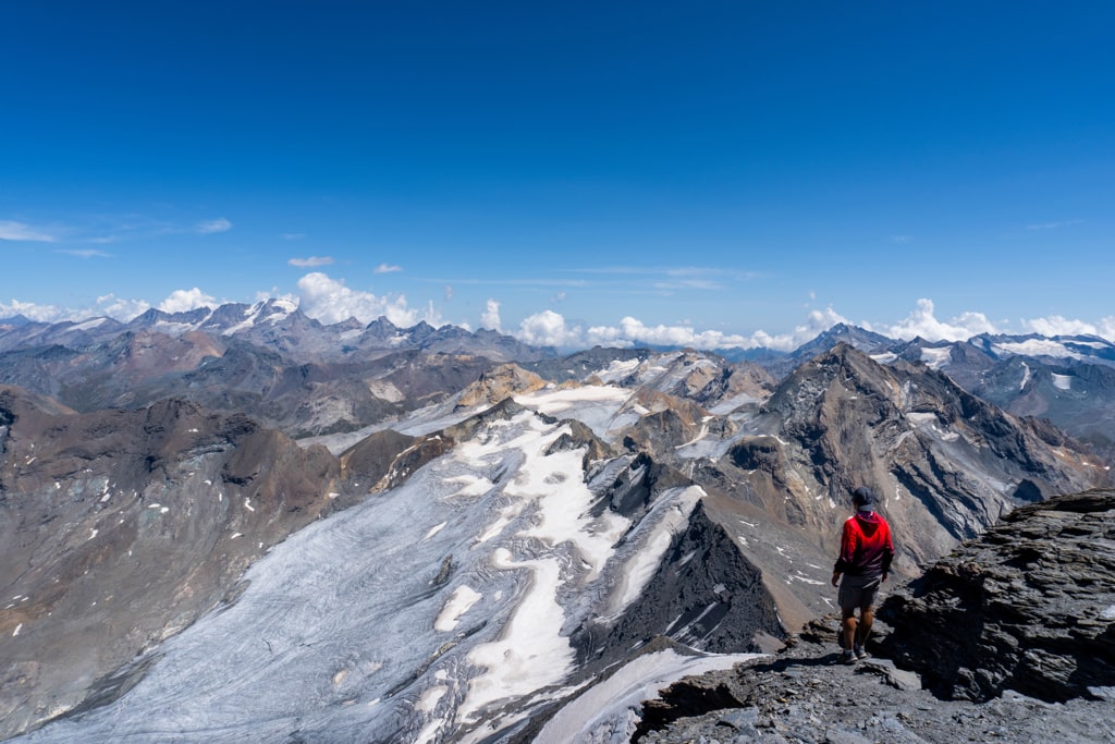
The final day of my hiking adventure in the French Alps is a challenging but rewarding trail that takes me to the summit of Aiguille de la Grande Sassière. The trail starts in Le Saut and covers a distance of 12 km with an elevation gain of 1450 m. The trail is steep in some sections and requires a good level of fitness, but the views from the summit are worth the effort. From the top, I could see the beautiful mountain ranges of the Mont Blanc massif and the surrounding valleys. After reaching the summit, I returned to Le Saut for a well-deserved rest and celebrated my accomplishment.
Le Saut - Aiguille de la Grande Sassière 3747m - Le Saut (Summer conditions)
- Distance
- 11.1 km
- Ascent
- +1,415 m
- Descent
- −1,414 m
- High point
- 3,676 m
- Lowest point
- 2,293 m
A Start: 45.48674, 6.96789▲ High point: 45.50505, 6.99974
Walking time, without breaks
- Relaxed11 h 10 min
- Average8 h 55 min
- Fast7 h 10 min
How steep
- Under 8% 1.0 km
- 8 to 15% 1.7 km
- 15 to 25% 2.9 km
- Over 25% 5.5 km
In two parts
- Up to the high point 5.5 km · +1,398 m
- Back down to the start 5.6 km · −1,401 m
In conclusion, the French Alps offer an abundance of hiking opportunities for all levels of hikers. This itinerary provides a balance of challenging and easy hikes and offers breathtaking views of the mountains and the surrounding villages. I ensured I came prepared with the proper gear and supplies, and most importantly, I enjoyed the journey!