For the trail · alpventurer.com/poco-da-ribeira-do-ferreiro-the-green-wall-of-flores-azores
Poço da Ribeira do Ferreiro – The Green Wall of Flores, Azores
Poço da Ribeira do Ferreiro · Portugal
- Time
- 45–60 min
- Difficulty
- Easy
- Season
- April–October
- Water
- Bring water; no facilities at the trailhead
- Parking
- Car park near the start, Free, 39.437071, -31.243405
In short
Poço da Ribeira do Ferreiro is an easy 2.6 km out-and-back walk from the car park near Fajãzinha on Flores. It takes 45 to 60 minutes and climbs 101 m, reaching a high point of 273 m. Visit from April to October, and bring water because there are no facilities at the trailhead.
The route
- Distance
- 2.6 km
- Ascent
- +101 m
- Descent
- −89 m
- High point
- 273 m
- Lowest point
- 177 m
A Poço da Ribeira do Ferreiro car park: 39.43597, -31.24350▲ Poço da Ribeira do Ferreiro: 39.43628, -31.23880
Walking time, without breaks
- Relaxed1 h 10 min
- Average0 h 55 min
- Fast0 h 45 min
How steep
- Under 8% 1.3 km
- 8 to 15% 0.7 km
- 15 to 25% 0.3 km
- Over 25% 0.0 km
What to pack
Every hike
- Water: about 1 litres (half a litre an hour)
- Food and snacks for the day
- Rain jacket
- A warm layer (fleece or light down)
- Sun cap, sunglasses and sun cream
- Boots or trail shoes with good grip
- Phone with the map offline, and a power bank
- Small first aid kit
- Headlamp, in case it gets late
- Some cash and your ID
Water and sun
- Swimsuit and a quick-dry towel, if you fancy a dip
- More water than usual in summer, and time in the shade
The guide
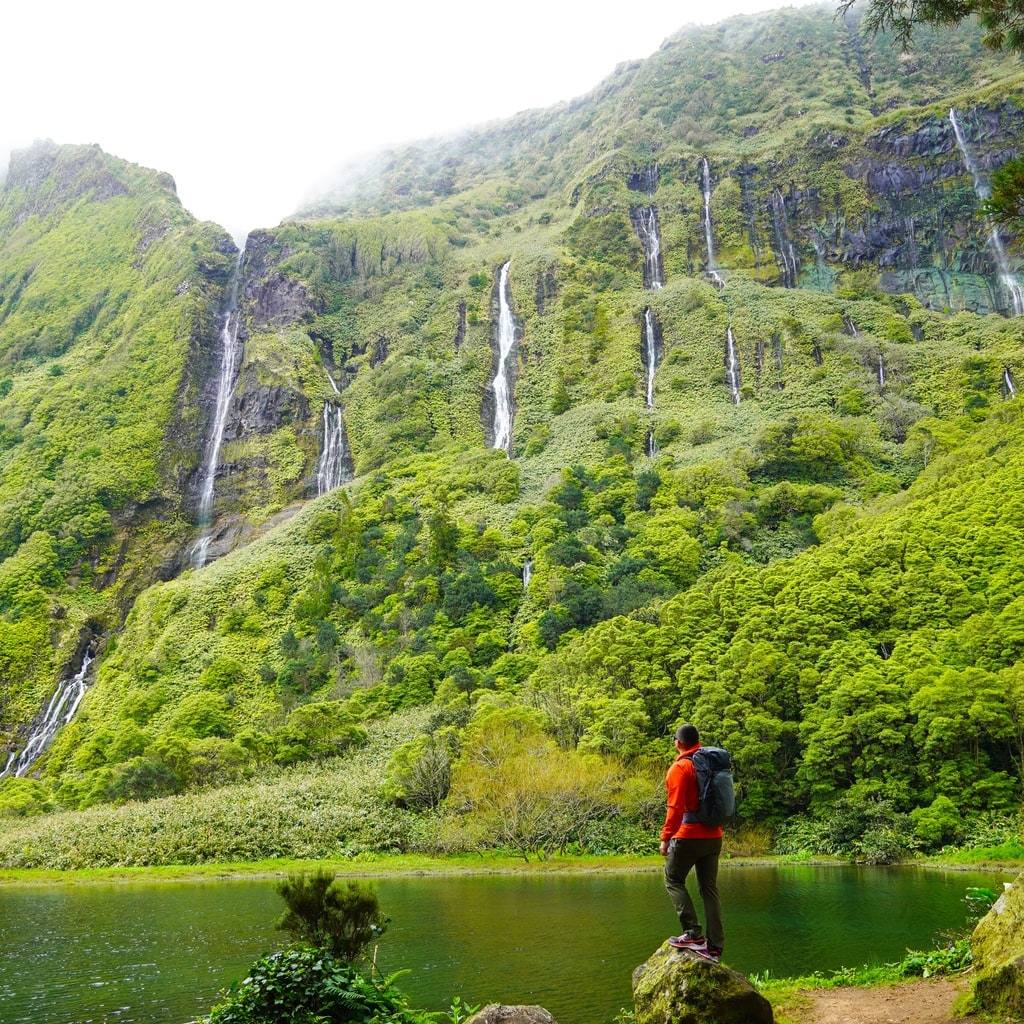
Few places in the Atlantic feel as otherworldly as Poço da Ribeira do Ferreiro, a vertical garden of waterfalls pouring down volcanic cliffs into a mirror-like lagoon. Locals call it Alagoinha — “the little lake.” Visitors know it as one of the most breathtaking corners of the Azores.
I hiked there on a misty morning from Fajãzinha, and it felt like walking straight into a painting. The sound of water is constant — hundreds of streams falling at once — but the mood changes with the light. One moment it’s emerald calm, the next it’s a moving wall of silver rain.
Overview
Trailhead: Poço da Ribeira do Ferreiro car park, near Fajãzinha
Distance: 2.6 km (round trip)
Elevation gain: 101 m
Difficulty: Easy
Time: 45–60 min total
Highest point: 273 m
Trail type: Out & back
The Trail
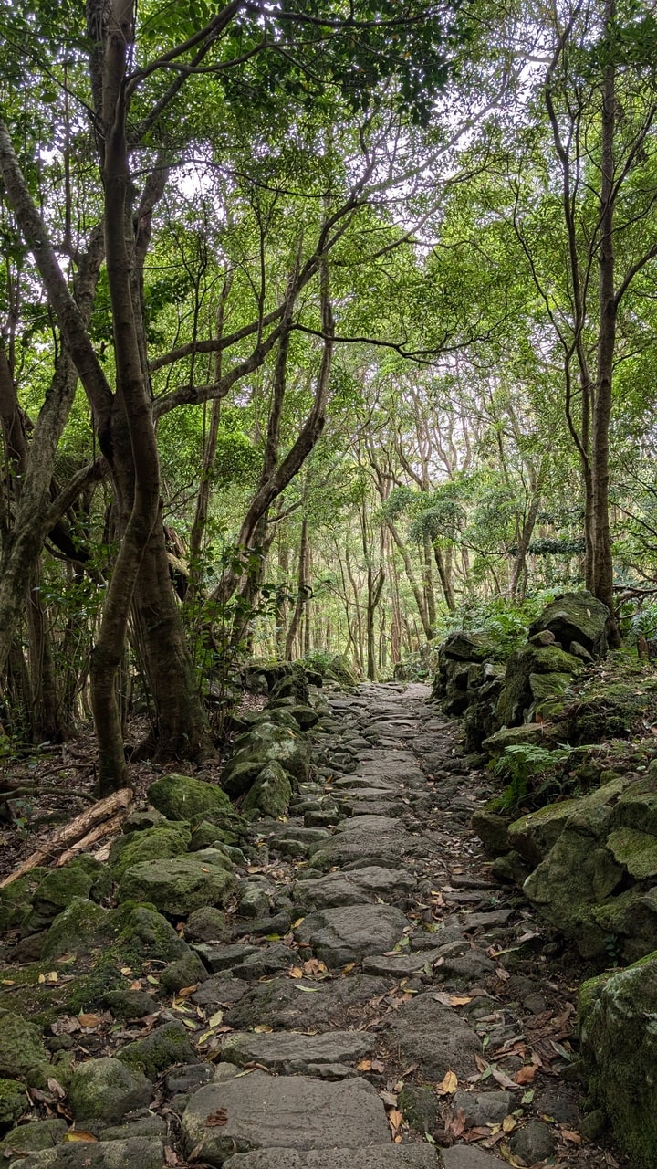
From the small parking area above Fajãzinha, a stone path climbs gently into a humid green valley. The trail is well maintained — part cobblestone, part packed dirt — shaded by Azorean juniper, hydrangeas, and moss-covered walls.
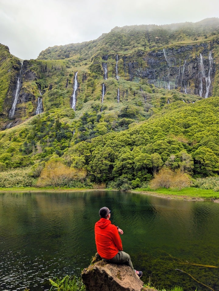
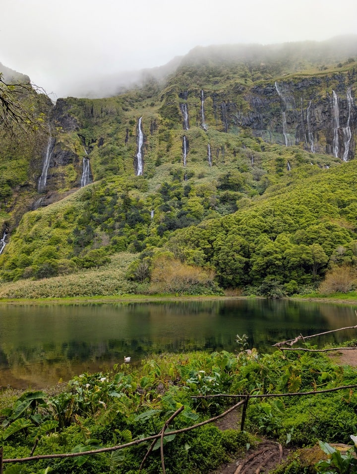
After about 20 minutes, the trees open to reveal the Lagoa dos Patos, a shallow lagoon surrounded by towering cliffs. In spring, dozens of waterfalls plunge down from the plateau — some thin, some wide, some vanishing into mist before they hit the surface.
This is Poço da Ribeira do Ferreiro — nature’s amphitheatre of water.
You can walk along the lagoon’s edge, where ducks sometimes glide on the green reflections. The cliffs rise almost 150 meters above you, and the sheer number of waterfalls depends on rainfall — sometimes a dozen, sometimes hundreds.
When to Visit
-
Best season: April–October (strongest waterfalls from winter and spring rains)
-
Time of day: Late morning or early afternoon — the cliffs face east, so light hits the falls best then.
-
Weather: Fog is common; wait 15–20 minutes and it often clears briefly. Rain only adds drama — just bring a waterproof jacket.
Getting There
-
By car: From Santa Cruz das Flores, drive 25 minutes west toward Fajãzinha. The signed road for Poço da Ribeira do Ferreiro leads to a small gravel parking area.
-
By foot: You can also walk from Fajãzinha village (about 1 km extra).
-
Public transport: None reliable — a rental car is essential on Flores.
If you have extra time, continue driving a few minutes north to Fajã Grande, the westernmost village of Europe. It’s small, beautiful, and a good base for exploring Cascata do Poço do Bacalhau and the Miradouro do Portal, which overlooks both Poço da Ribeira do Ferreiro and Ribeira Grande Waterfall from above.
Photography Tips
-
Bring a wide-angle lens — the cliffs are immense.
-
Use an ND filter if you want that soft, flowing look on the waterfalls.
-
A tripod helps, but you can also use rocks near the lagoon as natural supports.
-
In low clouds, shoot tighter compositions — the mist adds depth.
Notes for Visitors
-
Access: Free, open year-round.
-
Facilities: None at the trailhead — bring water.
-
Footwear: Waterproof shoes; the path can be muddy after rain.
-
Drone use: Not allowed in protected zones without a permit.
-
Leave no trace: Stay on the marked path; the lagoon shore is fragile.
Why It Matters
Flores means “flowers,” but it could just as well mean “water.” The island’s volcanic spine collects rain from the Atlantic and releases it here, in slow motion, down the green cliffs of Alagoinha.
Standing by the lagoon, surrounded by nothing but the sound of water and wind, it’s easy to forget the rest of the world exists.
It’s not a long hike — it’s a quiet arrival.
Practical Info
Trailhead: Poço da Ribeira do Ferreiro, Fajãzinha, Flores Island (39.43713944908145, -31.24333413331855)
Distance: 2.6 km return
Elevation gain: 101 m
Time: 1 h
Difficulty: Easy
Access: Free, open all year
Region: Azores, Portugal