For the trail · alpventurer.com/monkey-rock
Scenic Stroll to Monkey Rock: A Short Hike with Lake Tahoe’s Best Views
Scenic Stroll to Monkey Rock · United States
- Difficulty
- Easy
- Parking
- Car park near the start, 39.234463, -119.930458
- Bus & train
- Tunnel Creek Bonanza (Arrive), Bus ML Incline to Tahoe City – Incline to Tahoma, 370 m (5 min). Buses run about hourly, also on Sundays. Check the timetable for the last one back.
In short
Monkey Rock is an easy hike near Incline Village, Nevada, with views of Lake Tahoe. The 9.4 km route gains 400 m and reaches a high point of 2,315 m. The trail starts near Tunnel Creek Café, with parking at 1115 Tunnel Creek Road.
The route
- Distance
- 9.4 km
- Ascent
- +400 m
- Descent
- −402 m
- High point
- 2,315 m
- Lowest point
- 1,932 m
A 1115 Tunnel Creek Road parking: 39.23376, -119.92992▲ Monkey Rock: 39.22203, -119.90761
Walking time, without breaks
- Relaxed4 h 15 min
- Average3 h 25 min
- Fast2 h 45 min
How steep
- Under 8% 3.9 km
- 8 to 15% 4.3 km
- 15 to 25% 0.7 km
- Over 25% 0.2 km
In two parts
- Up to Monkey Rock 4.5 km · +392 m
- Back down to 1115 Tunnel Creek Road parking 4.6 km · −395 m
What to pack
Every hike
- Water: about 1.5 litres (half a litre an hour)
- Food and snacks for the day
- Rain jacket
- A warm layer (fleece or light down)
- Sun cap, sunglasses and sun cream
- Boots or trail shoes with good grip
- Phone with the map offline, and a power bank
- Small first aid kit
- Headlamp, in case it gets late
- Some cash and your ID
For the summit
- Hat and gloves: it is colder and windier at the top
- Walking poles, for the way down
Water and sun
- Swimsuit and a quick-dry towel, if you fancy a dip
The guide
When it comes to jaw-dropping Lake Tahoe views, you might expect a long, arduous trek. However, there’s a hidden gem that offers stunning panoramas without an all-day hike. Enter Monkey Rock, a picturesque destination that’s surprisingly accessible. Although its name may evoke images of primates, this adventure is more about embracing the beauty of Lake Tahoe. So, let’s embark on a short, scenic journey to Monkey Rock.
How to Get There
Getting to Monkey Rock is a breeze. Simply input “1115 Tunnel Creek Road” into your GPS, and you’ll arrive at a spacious parking lot. Be aware that during peak hours, parking can be a bit challenging due to the area’s popularity. However, if the lot is full, you can find parking alongside the road near the trailhead. On a recent visit, we lucked out with a spot not far from the trail’s starting point.
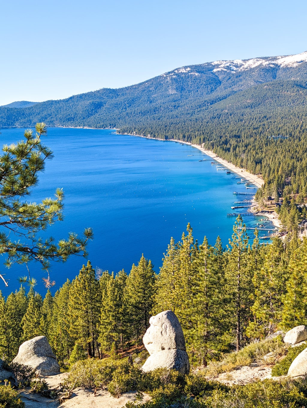
To locate the trailhead, head towards Tunnel Creek Café, following the paved road uphill. Continue along this road through the forest service gate, ignoring any “no parking” signs. As you progress, the road transitions to dirt, and a fantastic view of Lake Tahoe unfolds to your right. While the trail is uphill for most of the way, it’s manageable even for less experienced hikers.
About the Tunnel Creek Road and Monkey Rock hike
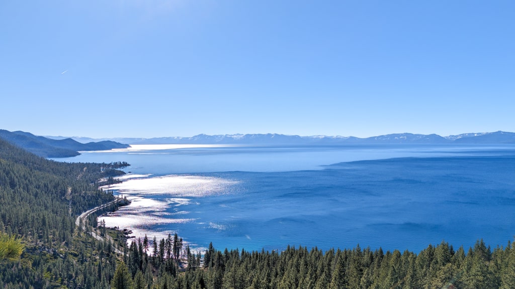
After approximately one kilometer, you’ll encounter another forest service gate. You can take a steep shortcut to Monkey Rock on your left, although we continued on the main trail for an additional half-mile. Look for a narrow trail to your left, which rejoins the shortcut. As you proceed, you’ll encounter a cluster of rocks, likely accompanied by fellow hikers. Amidst these rocks lies Monkey Rock, its peculiar shape a captivating sight against the backdrop of Lake Tahoe’s beauty.
While we couldn’t unearth much about the rock’s origin, it remains a unique and mesmerizing feature. The initial view may be somewhat concealed beneath other rocks, but the effort is well worth it. Take some time to soak in the breathtaking surroundings before your descent. Lake Tahoe’s allure never ceases to amaze, and Monkey Rock offers a fresh perspective.
For those seeking a longer adventure, continuing on the main trail will eventually lead you to the Incline Flume Trail and the Tahoe Rim Trail. On our journey, we chose to conclude our hike at Monkey Rock and opted for an extended walk along the Tahoe East Shore Trail, connecting Incline Village to Sand Harbor. The path provided an opportunity to relish the grandeur of Lake Tahoe before indulging in tri-tip burritos at T’s Rotisserie, a delightful conclusion to an unforgettable day.
While you won’t find any actual monkeys in Northern Nevada, your visit to Monkey Rock promises an experience well worth the walk. With minimal effort, you can savor the astounding vistas that Lake Tahoe generously bestows upon those who seek them.
Points of interest:
Starting point: 1115 Tunnel Creek Rd Parking (Google Maps)
Total distance: 9.4 km
Elevation gain: 400 m