For the trail · alpventurer.com/batoni-waterfall-arena-hike-switzerland
Hiking the Batöni Waterfall Arena – Switzerland’s Hidden Cascade Valley
Hiking the Batöni Waterfall Arena · Switzerland
- Distance
- 9.9 km
- Time
- 3.5–4.5 h
- Ascent
- +670 m
- Descent
- −670 m
- High point
- 1,647 m
- Difficulty
- Moderate
- Season
- May–July (snowmelt = full waterfalls)
- Water
- None on the trail until the waterfalls
In short
The Batöni Waterfall Arena is a loop hike from Weisstannen in eastern Switzerland. The route is 9.9 km, with 670 m of ascent, and takes 3.5-4.5 hours. It reaches 1,647 m and is best from May to July, when snowmelt feeds the waterfalls.
What to pack
Every hike
- Water: about 2 litres (half a litre an hour), all of it: no water on the way
- Food and snacks for the day
- Rain jacket
- A warm layer (fleece or light down)
- Sun cap, sunglasses and sun cream
- Boots or trail shoes with good grip
- Phone with the map offline, and a power bank
- Small first aid kit
- Headlamp, in case it gets late
- Some cash and your ID
Snow and ice
- Microspikes or crampons, as the snow needs
- Gaiters
- Insulated jacket and spare gloves
- A hot drink in a flask
- Check the avalanche bulletin before you go
The guide
In a quiet side valley of eastern Switzerland, deep inside the UNESCO World Heritage Tectonic Arena Sardona, there’s a place where three waterfalls fall into the same narrow basin — the Batöni Waterfall Arena.
It’s not just a viewpoint; it’s a natural amphitheater built by water and stone, a place where the sound of falling water echoes like a living instrument.
The Setting
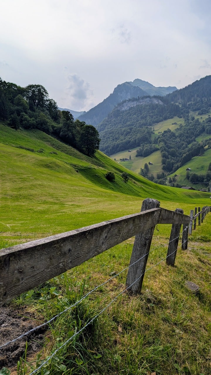
The trail begins in Weisstannen, a small alpine village in the canton of St. Gallen, surrounded by forested slopes and limestone peaks. From here, a steady path follows the Gadmerwasser River through meadows and pastures toward the cirque-shaped valley where the waterfalls converge.
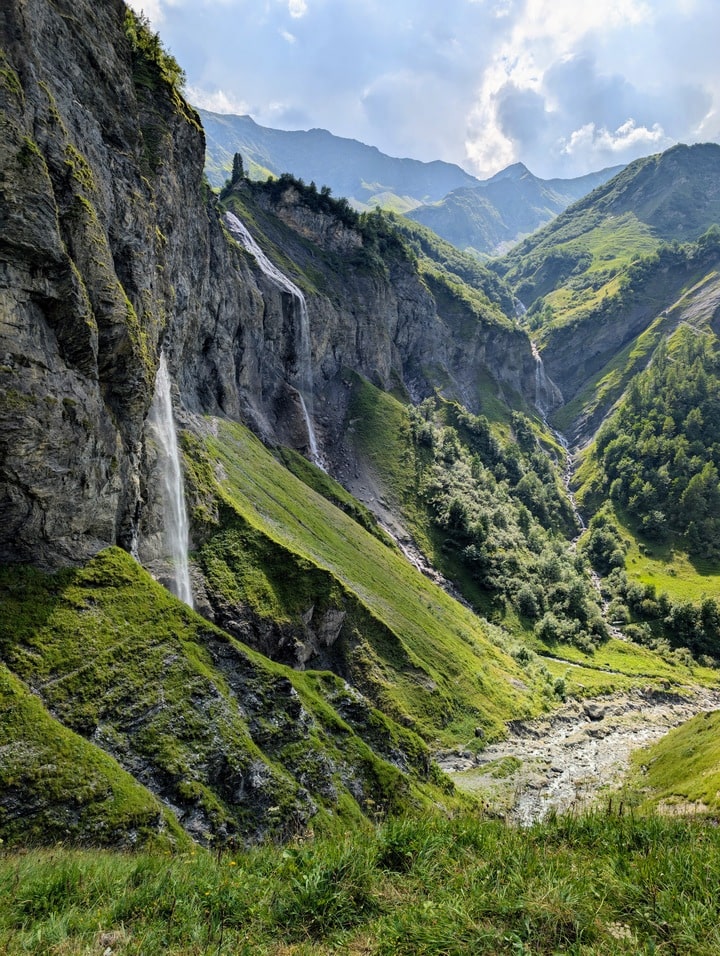
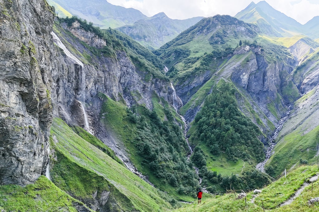
The arena itself lies at about 1,600 m, where streams from the Plattenbach, Sägenbach, and Muttenbach plunge hundreds of meters down from glacial cliffs into one bowl. Late spring and early summer bring the best spectacle — snowmelt turns every trickle into thunder.
Trail Overview
| Metric | Value |
|---|---|
| Distance | 9.9 km |
| Elevation gain/loss | 670 m |
| Max elevation | 1,647 m |
| Min elevation | 1,037 m |
| Duration | 3.5–4.5 h |
| Difficulty | Easy–Moderate |
| Type | Loop |
| Start/End | Weisstannen (Oberdorf bus stop or parking) |
The path climbs gently through the valley before steepening on gravel and forest sections. As you near the upper basin, the sound of the falls grows louder — a steady roar that fills the gorge before you even see the water.
The Arena
At the junction below the falls, you’ll find a small suspension bridge and two branching paths:
-
Left: short climb to the classic viewpoint — where all three waterfalls align in a wide amphitheater.
-
Right: a bridge crossing and optional detour loop that climbs above the valley for more open panoramas.
From the upper viewpoint, the waterfalls appear almost choreographed — white ribbons against dark cliffs, framed by moss and alpine forest. The area feels closed off from the world, a self-contained ecosystem of mist and echo.
Photography Notes
-
Best light: early morning or late afternoon, when the sun hits the valley at an angle.
-
Bring: tripod, ND filter — the waterfalls are made for long exposures.
-
Drone use: prohibited (UNESCO site).
-
Composition tip: vertical shots work best — the valley walls are steep and narrow.
Getting There
-
By car: Drive to Weisstannen (near Sargans). First parking lot is at the village entrance; second near the Oberdorf bus stop by the bridge.
-
By public transport: Train to Sargans, then Bus 432 to Weisstannen Oberdorf (approx. 1 h).
-
Facilities: small inns and guesthouses in Weisstannen; no services on trail.
Notes for Hikers
-
Best season: May–July (snowmelt = full waterfalls).
-
Trail condition: gravel, forest paths, and some steep wet sections — sturdy shoes recommended.
-
Bring water: none available on the trail, until reaching waterfalls
-
Caution: bridge and upper detour can be slippery when wet.
-
Loop option: complete via the opposite valley wall for wider mountain views.
Reflections
Few places combine sound, scale, and solitude like Batöni.
It’s not a big mountain climb or a high pass — it’s a small amphitheater carved by time, water, and gravity. You stand there surrounded by movement, but everything feels still.
For an hour, you forget about Switzerland’s trains and timetables — and listen to something older than both.